St Aubin's Fort

St Aubin's Fort

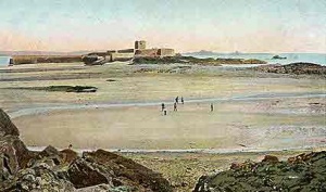
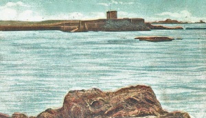
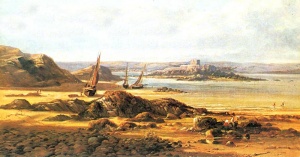
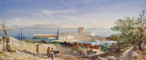
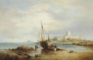
1840 etching
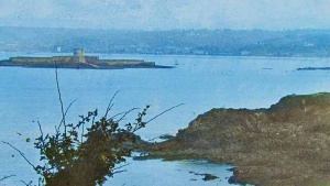
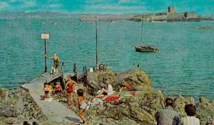
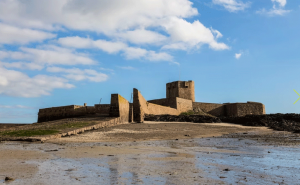
St Aubin's Fort was developed on a rocky islet off the coast at the western end of St Aubin's Bay

Ships unloading their cargo into carts on the beach at St Aubin were vulnerable to attack by pirates coming into the bay. This was a particular problem in the 16th century when pirate vessels from Brittany and Belgium roamed the Channel and sailed into island waters looking for easy prey. A bulwark (earth work) with two guns was constructed on shore, giving the area the name, Bulwarks, it still has today, and then a tower was constructed on the offshore rocky islet to house four more gunners.
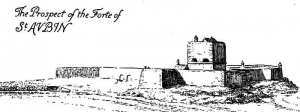
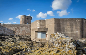
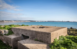
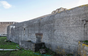
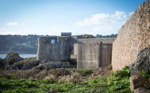
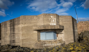
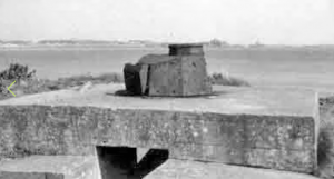
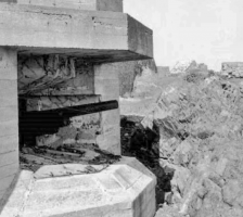
A century later in the Civil War the Parliamentarians turned it into a stronger fortress, by building a bulwark on it, and when the Royalists regained possession they replaced this with granite ramparts and added a storey to the tower. In the 18th century, and again in the 19th, the fort was rebuilt twice, but in peaceful Victorian times it was let as a summer residence. In the Second World War the Germans strengthened the fort with turret guns and concrete casemates.
Jetty built
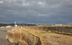
As trade grew at St Aubin the demand grew for better harbour facilities and King Charles II ordered a pier to be built, paid for by import dues. The States wanted it to run out from the shore to the south of where today's southern pier lies, but time slipped by without work starting and the Governor, Sir Thomas Morgan, decided to take charge and ordered a pier to be built out from the fort in 1675.
The man who developed the fort
History

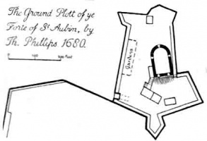
It's certainly not there now, but was this building, which looks like a typical Jersey two-storey five-bay farmhouse of the 18th century, actually built on St Aubin's Fort? This plan, drawn by I Manson, certainly suggests that the building, described as a 'Barracks and Sutlinghouse' was in existence in 1755, and not just a proposed addition. The building would be where the soldiers who manned the fort lived, slept, ate and relaxed. There is mention of a 'suttling house' (probably the correct spelling) in a 1948 article in the Annual Bulletin of La Société Jersiaise and a building of this shape and description appears on a 1742 plan further down this page, built in what were described as the 'gardens' on a 1680 plan, also included below.
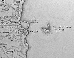
The second map, with enlarged sections, was drawn three decades earlier, by Peter Meade in 1737. It shows that the development of St Aubin's Harbour had not started and the only available landing place was on the sand in the lee of the fort, or against it's small jetty when the tide was in


-
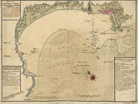 The section of Peter Meade's map showing the whole of St Aubin's Bay
 -
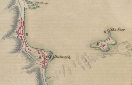 St Aubin without its harbour
 -
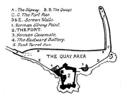
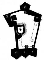
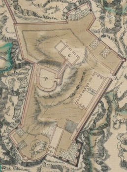 A detailed plan of the fort


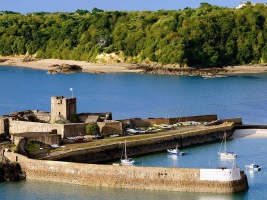
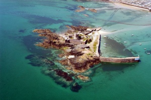
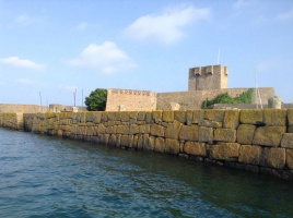
The next four photographs were taken from drones in 2023 and 2024, top left by Cetin Ketirci, and the other three by Paul Lakeman. His picture at the bottom left shows clearly how the Fort was developed with a long pier and jetty at right angles when this was the island's main commercial harbour


Click on any picture to see a larger image
-
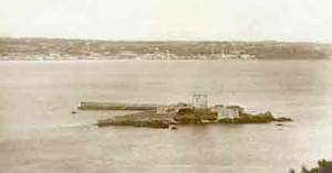
 Lantern slide, c1900
 -
 A 1948 drawing of the fort
 -
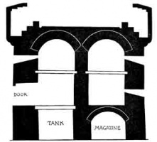 A section through the tower
 -
-
-
-
-
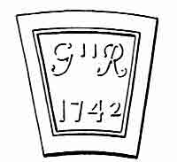
 1742 plan


.jpg)


-
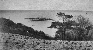
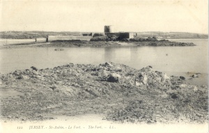
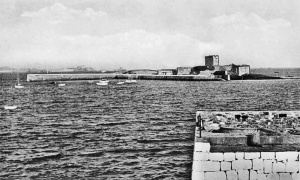
 The fort in 1906
 -
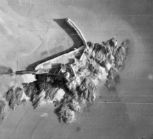
 The fort from the air
 -
-
-
-
-
 1890
1890 -
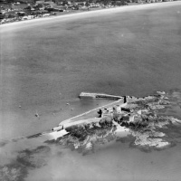 1933 aerial photograph by Aerofilms


-
-
-
-
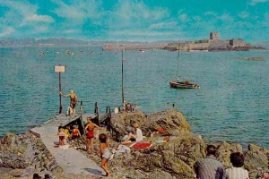
 LL postcard
 -
-
-
-
 By A Herbert
 -
 by Henry King Taylor
 -
-
-
-
-
 1985
1985 -
-
-
-
-
-
-
-
-
-