The 'green books'

The Green Books

Commonly referred to as the Green Books, the Taldische Wersichten der Festungsbereich (Tactical Review of the Fortress Area Jersey) provides an overview of the defences and military infrastructure in Jersey in late 1944. The 319 Divisionskartenstelle (Divisional Cartograpghic Section) were commissioned by Generalleutnant von Schmettow to produce a complete record of the island’s defences.
The books were taken to the UK by British troops after the island was liberated in 1945.
On 29 October 1947 an incomplete set was presented by the War Office, via the Island's Lieut-Governor, Sir Edward Grasett, to La Société Jersiaise
In 1975 a second set of these pictures was acquired by the Channel Island Occupation Society. They were assembled into two albums which now form part of the Society's collection at Jersey Archive [1]

Some of these official photographs of German installations were already included on other Jerripedia galleries relating to the Occupation some time before the creation of this gallery. Various sets of these images have been available online for a number of years. Some of the Green Books were included in the Jersey Heritage online catalogue and were copied and uploaded to Jerripedia in 2012. The books were subsequently removed from view and did not resurface until all nine appeared in the new Société website in 2022.
The year before, Jerripedia independently acquired another set of pictures which we now know form part of the CIOS collection. They had been awaiting processing for nearly two years before this page was assembled.
This new gallery [2], containing a representative selection of the photographs in the Société Jersiaise Green Books and the CIOS albums [3], was created in 2023. There are still significant parts of the German defences which are not included, most notably the major installations at Noirmont - Batterie Lothringen - and Les Landes - Batterie Moltke. Jerripedia's own collection of Occupation pictures includes these two locations. A number of installations at the northern end of St Ouen's Bay are also missing. Most of these locations are believed to be covered in the second of the two CIOS albums held by Jersey Archive, which has not been made available online and can only be seen at the Archive.
-
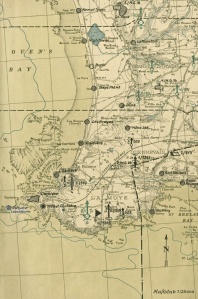
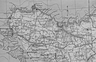
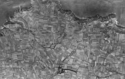
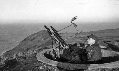
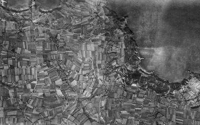
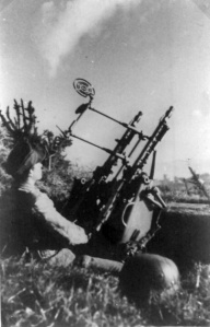
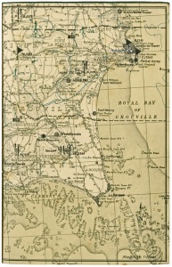
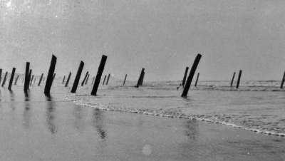
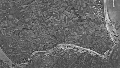
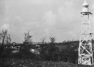
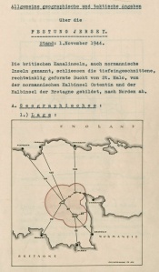
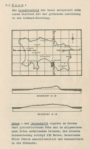
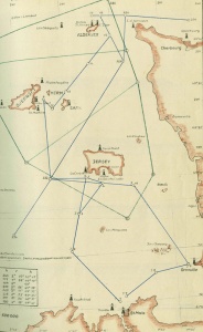
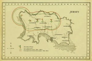 A map showing the coverage of anti-aircraft guns
 -
-
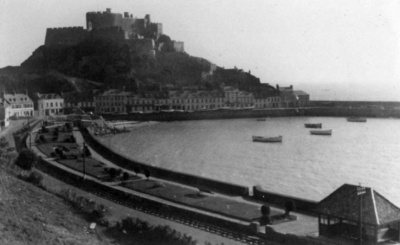
 La Motte/Green Island


Societe Jersiaise blog article
As part of its 150th anniversary celebrations in 2023 La Société Jersiaise created a blog in its website, featuring a series of articles by Martha MacDonald, including the following on the Green Books.
- "As we approach 78 years since the Channel Islands’ Liberation, those of us who did not live through that period of history are once again confronted by the difficulty of fully understanding the harsh realities of the Occupation. How does a community preserve its connection to the past at the point when those events are no longer in living memory? Whilst this question is complicated and deeply troubling, the Islands’ extensive historical archives surely provide some reassurance when facing this challenge.
- "One such collection that sheds light on life under Occupation resides at the Société Jersiaise in the form of the Green Books (so called after their green covers) – a collection of surveys and field guides which were ordered by Nazi High Command to document war time defences in both Jersey and Guernsey. Also known as Festung Jersey (‘Fortress Jersey’), the Green Books record in meticulous detail how the German Occupying Forces defended each stretch of coastline around the Island.
- "Whilst the core purpose of these books is to provide a military record including inventories of weapons, personnel and details of fortifications, bases, and other infrastructure – the way they are presented is rather surprising. The concrete and gunmetal of the Nazi’s presence on the island is interspersed with detailed and sensitive renderings of the island’s coastline in watercolour. Painting, drawing, cartography, photography, calligraphy and other creative skills possessed by non-commissioned officers in the German 319 Divisional Cartographic Section were all deployed to produce the Green Books.
Artistic skill
- "Careful, neat and with great artistic skill, this collection is certainly not what you would expect from documents originating from one of the most brutal and challenging times in both local and world history. The books were taken to the UK by British Troops after the island was liberated in 1945. On 29 October 1947 an incomplete set of these books was presented by the War Office, via the Island’s Lieut-Governor, Sir Edward Grasett, to the Société Jersiaise.
- "While incomplete, the collection of Green Books provides an excellent resource for local historians and Occupation researchers. I sat down with one such researcher, Paul Burnal, a former soldier whose mother was a child in Jersey during the Occupation. Due to this family connection and his military service, Paul explained that he’s always had a 'fascination' with this era of history and, since he retired, he has pursued his interest by writing books about German defences around the island. In this endeavour, the Green Books (in addition to his own field research) have provided him with a wealth of information when researching his own books.
- "'Having an interest in the German fortifications, the Coastal Defensive System [and] the Atlantic Wall – which I’ve had since I was knee high to a grasshopper – I just wanted to study and research more and more about how the Germans defended the Island.”
- "He explained that his experience as an Infantryman in the British Army helps him to analyse these defences from a military strategy perspective: 'This is what the infantry would have been coming up against, how would they have overcome that obstacle? How would they have got past those fortifications? When I write my books, I try and look at it from a soldier’s perspective and say: "this is the defensive position, this is the weapons they’ve got, this is the land, and this is how the Germans would have defended it." So, if you’re attacking this is what you’ve got to get through: and it is quite frightening.'
- "Much of that information about the nature of the German defences is detailed in the Green Books, which became crucial for Paul when researching for his second book Defence Sector East. With their precise level of detail, the books also provided something of a template for Paul when it came to structuring his own writing.
- "'How the Green Books are laid out, that’s how my books are laid out. I follow the same format as theGreen Books: and I just try to elaborate on it and put a bit more detail in.'
'Vitally important history'
- "Commenting on the significance of this collection for local and world history, Paul remarked: 'I would say it’s vitally important. The German Occupation was probably the most momentous part of the island’s history within the context of the Second World War. I think the fact the Occupiers went to such lengths to show how well they had fortified the islands, it’s amazing.'
- "However, he expressed concern that, aside from the island’s annual Liberation Day celebrations, interest in this period of history is 'waning'.
- "'Hopefully, interest in the Occupation will never die off. There will always be that element of people who have got that interest and they’ll want to come and look at the Green Books, so the fact that we’ve got this collection here it’s a vitally important part of the island’s history.”
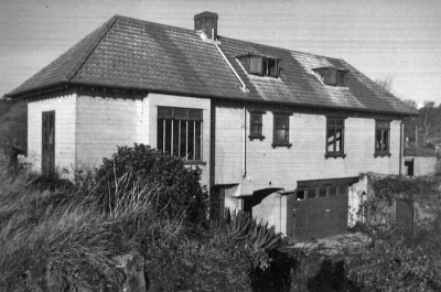
- "The Société Jersiaise has recently digitised its entire collection of Green Books so that they are available to view online for free. Remarking on this, and on the collection in general, Librarian at the Société Jersiaise, Valérie Noël said: 'The Channel Islands were the only part of the British Isles occupied by German forces during the Second World War. They built a series of fortifications designed to make the islands impregnable, as part of the Atlantic Wall. Festung Jersey or Green Books are the record of the German wartime defences in Jersey.
- "'The collection is unique, having been written by the German forces themselves. It is a rich resource for Occupation researchers and contains several drawings, photographs, maps, and watercolours depicting the island at the time of the Occupation. This collection is very popular among Jersey Occupation researchers and its digitisation will allow a wider audience to discover this unique resource.'"
Images enhanced
Many of the images from both sets are in very poor condition. The Jerripedia team spent many hours digitally enhancing them as far as possible. Some of the poorest have had to be excluded. It appears that the Army division commissioned to take the photographs did not use a professional photographer. Perhaps nobody suitable was present in the island at that time and nobody could be brought in from Germany that late in the war. Some of the photographs include very strange subjects and the suspicion is that many were 'snapshots' taken by the men manning the installations at the time - using the equivalent of Box Brownies rather than Army issue Leicas.
Because of the overlap between the two collections we have not attempted to follow the division into specific sectors as used in the nine Green Books, but to divide the pictures into more general coastal zones. Our gallery starts at St Helier Harbour and follows the island's coastline in a clockwise direction.
Links to 21st century pictures of some of the installations in the website bunkersite.com are included in the footnotes.
Click on any thumbnail picture to see a larger version. Some captions are revealed by moving the cursor over a picture
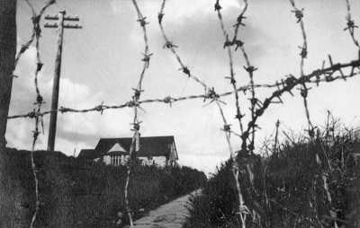
St Helier Harbour [4]

-
 Albert Pier
 -
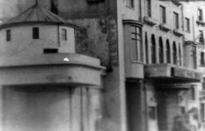 Air raid shelter on the corner of Conway Street next to the Pomme d'Or Hotel
 -
-
 South Hill viewed from the Albert Pier


West Park [5]
-
-
-
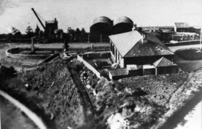
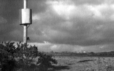
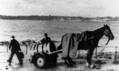 Gathering sea water at West Park


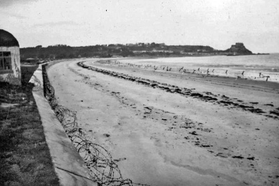
St Aubin's Bay [6]

-
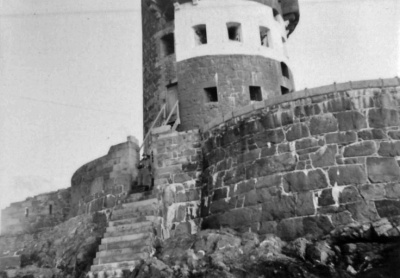
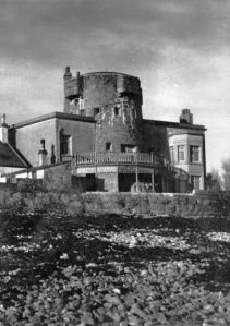
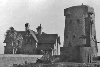
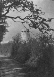
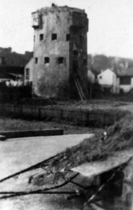 Beaumont coastal tower
 -
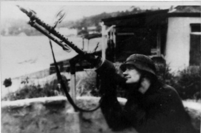
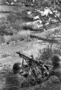
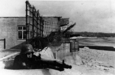 Machine gun at Beaumont
 -
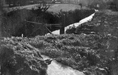
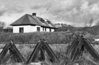
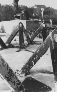 Tank traps at La Haule
 -
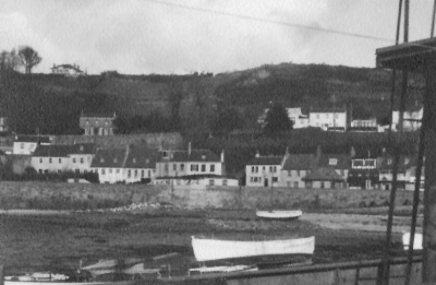
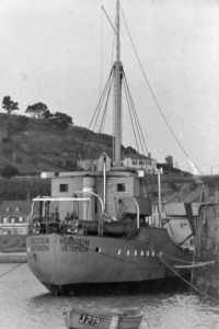
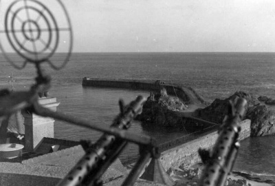
 St Aubin's Harbour
 -
 St Aubin's Harbour
 -
 St Aubin's Harbour


South west coast


-
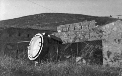
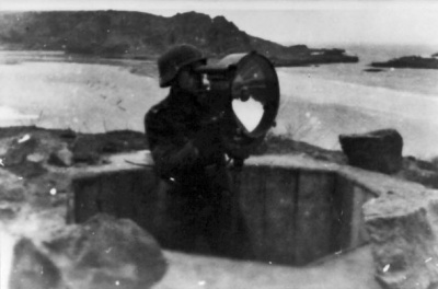 Searchlight at Ouaisne
 -
 Le Grouin sentry post
 -
 Machine gun at Le Grouin
 -
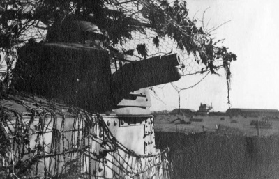
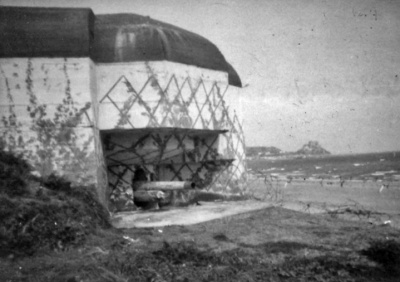
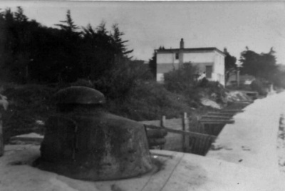 St Brelade's Bay gun turret
 -
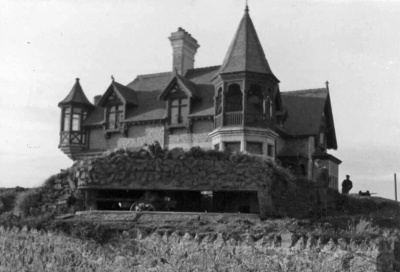
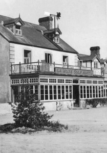 La Moye Golf Hotel was used for troop accommodation
 -
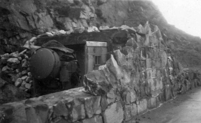
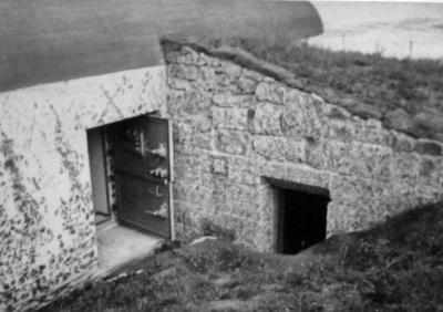
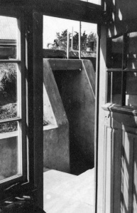 La Moye bunker entrance
 -
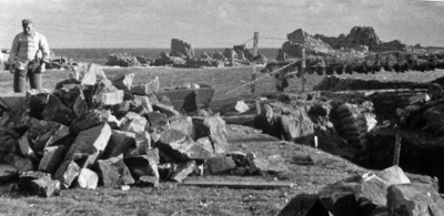 Construction work at Corbiere
 -
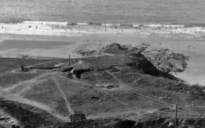
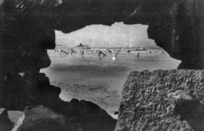
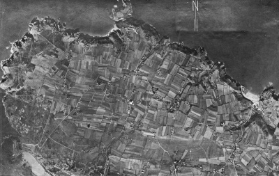
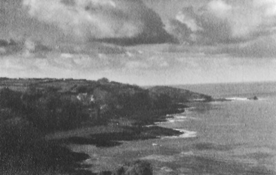
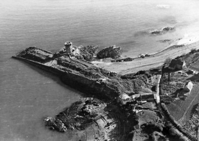
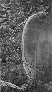
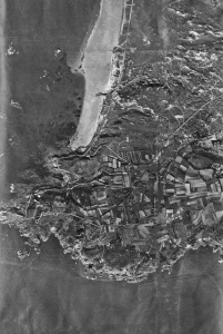 Aerial view of the south-west coast ...
 -
 ... and a corresponding map
 -
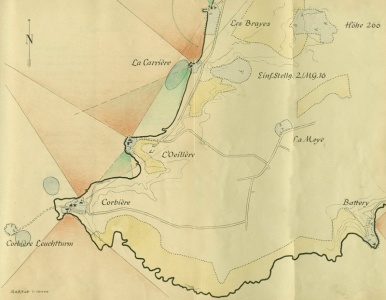 Hand-drawn map showing the positions of the defensive installations at Corbiere, La Moye, and, further up St Ouen's Bay, the resistance nests at L'Oeilliere, La Carriere and Les Brayes
 -
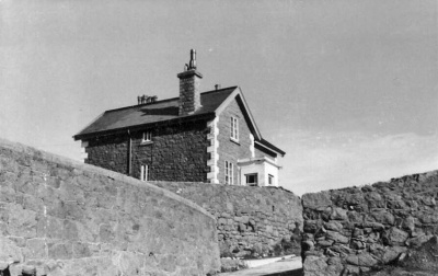 Day accommodation for troops at Corbiere
 -
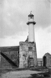
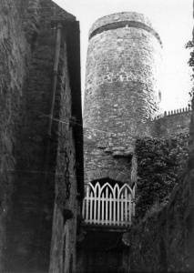
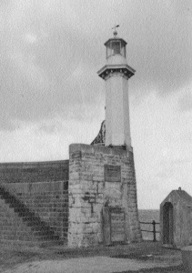
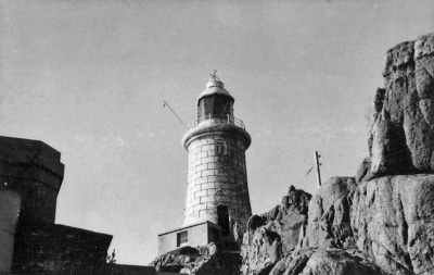 Corbiere lighthouse


West coast


-
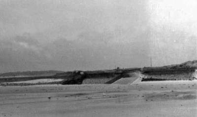
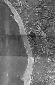 St Ouen's Bay aerial ...
 -
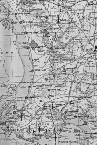 ... and corresponding map
 -
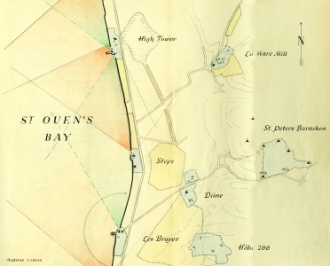 A hand-drawm map of the centre of the bay showing the location of Les Brayes, Hohe 266, Dune, St Peter's Barracks, Steps, La Mare Mill and High Tower, all locations of Wiederstandnests (resistance nests) with pictures shown below
 -
 Wiederstandnest L'Oeillere, manned by three NCOs and 12 men, this installation defended Petit Port and the southern end of St Ouen's Bay
 -
 A sentry at L'Oeillere, with the sweep of the bay behind
 -
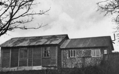
 An old hut used for daytime accommodation at L'Oeillere
 -
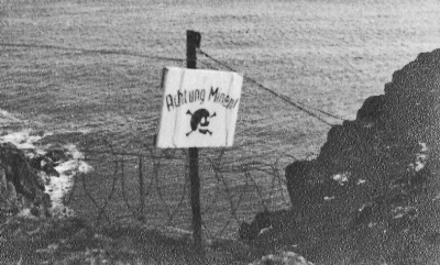
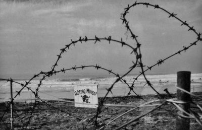 Warning of a minefield at WN La Carriere which, manned by three NCOs and 12 men, covered the southern end of the bay
 -
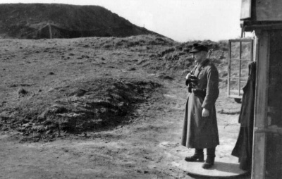 Sentry on duty at La Carriere
 -
 The view out to sea from Wiederstandnest La Carriere at the southern end of the bay
 -
 Les Brayes viewed from the sea. Manned by three NCOs and 12 men, this was one of the main defences of the southern end and centre of the bay
 -
 Old huts for daytime accommodation at Les Brayes
 -
 Looking out to La Rocco Tower from Les Brayes
 -
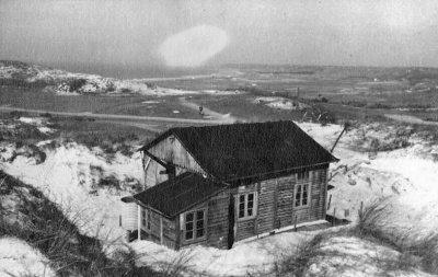
 Wiederstandnest Hohe 266 was situated in the dunes back from the coast and, manned by three NCOs and 12 men, covered a large expanse of the bay
 -
 Daytime accommodation at Hohe 266
 -
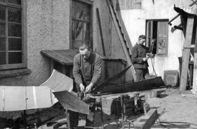 Two soldiers at work at Hohe 266
 -
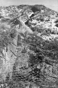 A camouflaged gun installation at Hohe 266
 -
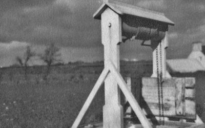
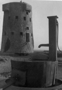
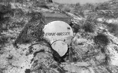 Drinking water for the men at Hohe 266
 -
 A bunker entrance at Hohe 266
 -
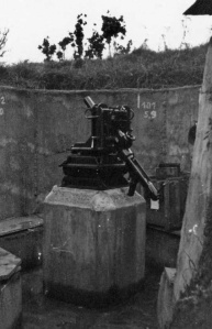
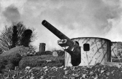
 A 10.5 cm field gun at Hohe 266
 -
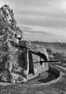
 An anti-aircraft gun at Wiederstandnews Dune which, as the name suggests, was in the sanddunes at the back of the bay
 -
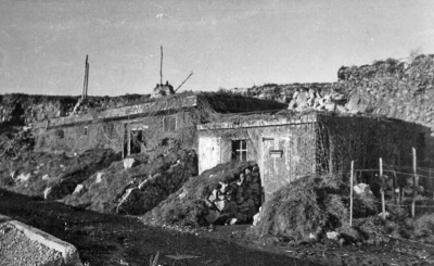
 Accommodation at WN Dune
 -
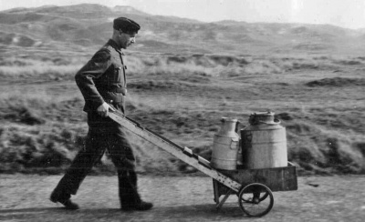 The daily milk collection for WN Dune
 -
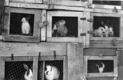 Rabbits kept for food at WM Dune
 -
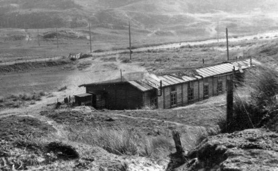
 Although shown as WN Dune in the St Ouen's Bay Green Book, we think this and the following five pictures show St Peter's Barracks, on the edge of the airfield
 -
 St Peter's Barracks were inland from WN Dune
 -
 St Peter's Barracks? The Airport building can be seen in the distance
 -
 St Peter's Barracks?
 -
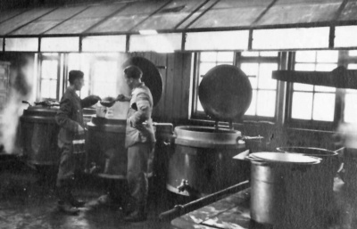 St Peter's Barracks kitchen?
 -
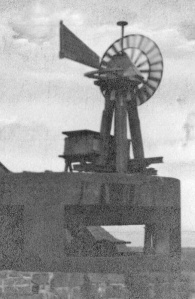
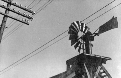 St Peter's Barracks windmill?
 -
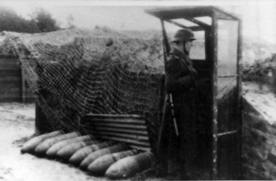
 WN Steps, manned by four NCOs and 16 men, was positioned on the coast to defend against attack from the sea, from the low-lying land behind and also to attack overflying aircraft
 -
 WN Steps
 -
![Einsatzstellung Bucht was a mortar and machine gun position above the seawall [7]](/w/images/thumb/e/ec/SJ23GreenBookEinsatzstellungBucht1.jpg/400px-SJ23GreenBookEinsatzstellungBucht1.jpg) Einsatzstellung Bucht was a mortar and machine gun position above the seawall [7]
Einsatzstellung Bucht was a mortar and machine gun position above the seawall [7] -
 Bucht
Bucht -
![Accommodation at WN La Mare Mill, which was manned by four NCOs and 16 men and could engage attacks from the sea, land and air [8]](/w/images/thumb/5/55/SJ23GreenBookWNLaMareMill1a.jpg/400px-SJ23GreenBookWNLaMareMill1a.jpg) Accommodation at WN La Mare Mill, which was manned by four NCOs and 16 men and could engage attacks from the sea, land and air [8]
Accommodation at WN La Mare Mill, which was manned by four NCOs and 16 men and could engage attacks from the sea, land and air [8] -
 Camouflaged gun at WN La Mare Mill
 -
 Distribution of post to the men at La Mare Mill
 -
 WN La Mare Mill
 -
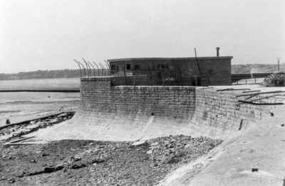
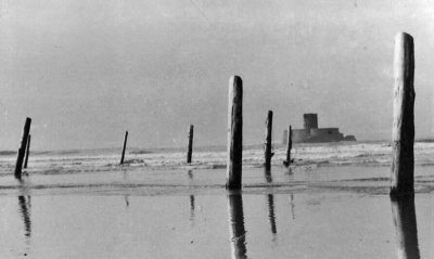
 The original coastal tower, known as High Tower, was demolished to build the new defensive installation, manned by four NCOs and 15 men, covering the centre of the bay against attack by sea, land and air.
 -
 Accommodation at WN High Tower
 -
 High Tower viewed from the sea
 -
 Another view from the sea
 -
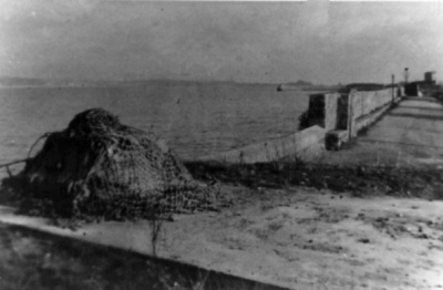
 Tank traps at High Tower
 -
 More tank traps
 -
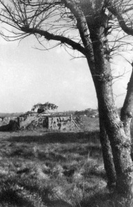
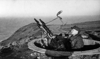
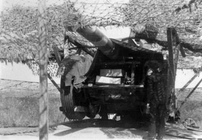
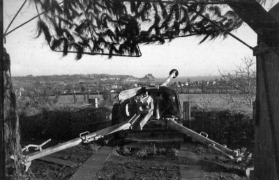
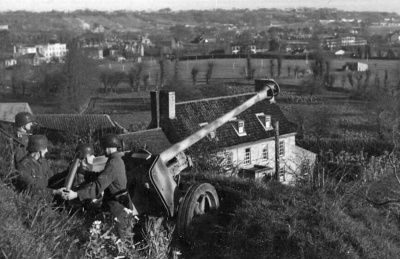
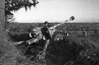
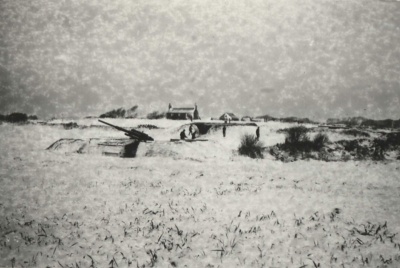 Mont Rossignol flak battery, Batterie Metz, covered in snow


![Einsatzstellung Bucht was a mortar and machine gun position above the seawall [7]](/wiki/File:SJ23GreenBookEinsatzstellungBucht1.jpg)

![Accommodation at WN La Mare Mill, which was manned by four NCOs and 16 men and could engage attacks from the sea, land and air [8]](/wiki/File:SJ23GreenBookWNLaMareMill1a.jpg)


North coast


-
 A map of the north coast at Plemont ...
 -
 ... and corresponding aerial photograph
 -
![Stutzpunkt (strongpoint) Plemont, was a major installation with multiple elements, manned by four NCOs and 28 men, protecting the north-west corner of the island from invasion [9]](/w/images/thumb/7/77/SJ23GreenBookPlemont1Accommodation.jpg/400px-SJ23GreenBookPlemont1Accommodation.jpg) Stutzpunkt (strongpoint) Plemont, was a major installation with multiple elements, manned by four NCOs and 28 men, protecting the north-west corner of the island from invasion [9]
Stutzpunkt (strongpoint) Plemont, was a major installation with multiple elements, manned by four NCOs and 28 men, protecting the north-west corner of the island from invasion [9] -
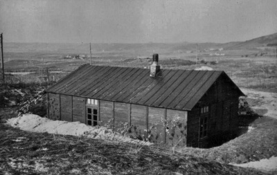
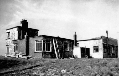
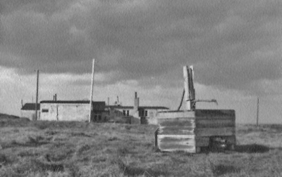
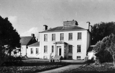 Morville House was used as accommodation for the men ...
 -
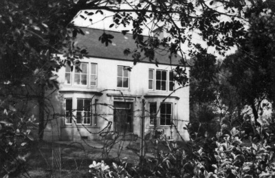 ... as was this nearby, unidentified property
 -
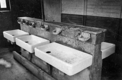 The men's wash-house
 -
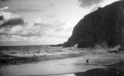 The bay in 1944
 -
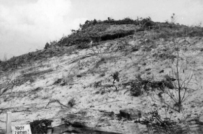
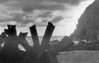 Tank traps
 -
 Wiederstandnest Jute was half way between Plemont and Greve de Lecq. It was manned by two NCOs and 13 men
 -
 A well-camouflaged gun protects the approach to WN Jute
 -
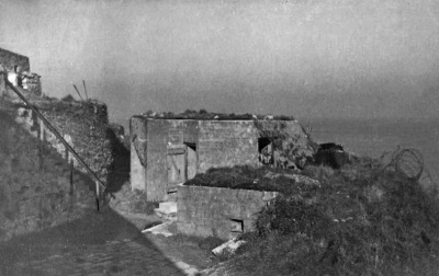
 The photographs of Stutzpunkt Greve de Lecq reveal little of the substantial installation there, manned by 4 NCOs and 30 men. Some are missing from the Green Book. This picture shows a searchlight
 -
![The entrance to a casemate at STP Greve de Lecq [10]](/w/images/thumb/d/d4/SJ23GreenBookGreveDeLecqCasemateENtrance.jpg/400px-SJ23GreenBookGreveDeLecqCasemateENtrance.jpg) The entrance to a casemate at STP Greve de Lecq [10]
The entrance to a casemate at STP Greve de Lecq [10] -
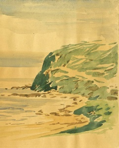 A drawing of the coastline from the Green Book
 -
 Windmill to generate power
 -
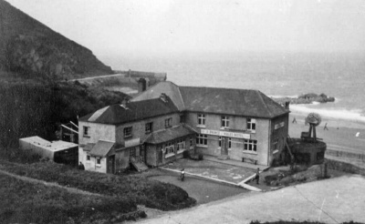 The Prince of Wales Hotel was commandeered to house troops


![Stutzpunkt (strongpoint) Plemont, was a major installation with multiple elements, manned by four NCOs and 28 men, protecting the north-west corner of the island from invasion [9]](/wiki/File:SJ23GreenBookPlemont1Accommodation.jpg)


![The entrance to a casemate at STP Greve de Lecq [10]](/wiki/File:SJ23GreenBookGreveDeLecqCasemateENtrance.jpg)


There were two defence complexes close to each other on the north coast, designated Sorel A [11] and Sorel B [12]. The larger of the two, Sorel B, was manned by four officers, three senior NCOs and 27 men. Armaments included a 10.5cm cannon. Sorel A was manned by four NCOs and 16 men. As well as a 60cm searchlight, its weaponry included six flame throwers
-
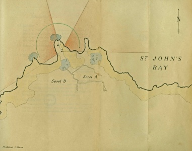 A hand-drawn map showing the exact location of the two Wiederstandnests
 -
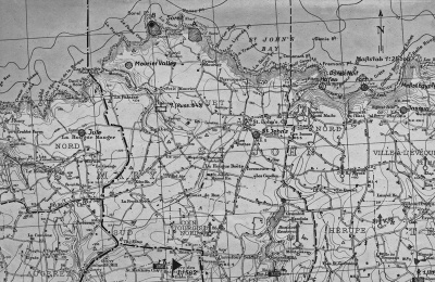 A general map of this area of the north coast ...
 -
 ... and a corresponding aerial photograph
 -
 Sorel A viewed from a distance
 -
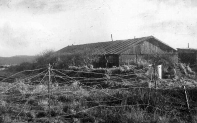 Day accommodation at Sorel A
 -
 Sorel B
 -
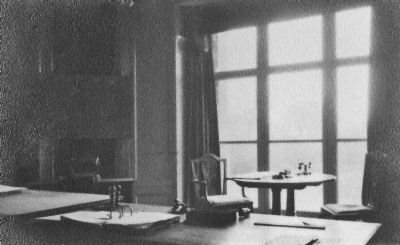
 This house was used to accommodate men from both resistance nests
 -
 Sorel B minefield
 -
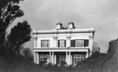 Melbourne House, some distance from Sorel, was also used for troop accommodation
 -
 Melbourne House
 -
 A sentry at Sorel B
 -
![La Crete Fort, [13] in the middle of Bonne Nuit Bay, was built in 1834 as protection against a French invasion. The Germans adapted it for their own use as a small resistance nest, manned by one NCOs and six men [14]](/w/images/thumb/8/84/SJ23GreenBookLaCreteFort.jpg/400px-SJ23GreenBookLaCreteFort.jpg) La Crete Fort, [13] in the middle of Bonne Nuit Bay, was built in 1834 as protection against a French invasion. The Germans adapted it for their own use as a small resistance nest, manned by one NCOs and six men [14]
La Crete Fort, [13] in the middle of Bonne Nuit Bay, was built in 1834 as protection against a French invasion. The Germans adapted it for their own use as a small resistance nest, manned by one NCOs and six men [14] -
![A defence position at Bonne Nuit [15]](/w/images/thumb/5/58/SJ23GreenBookBonneNuitDefencePosition.jpg/400px-SJ23GreenBookBonneNuitDefencePosition.jpg) A defence position at Bonne Nuit [15]
A defence position at Bonne Nuit [15] -
 Looking down on the jetty at Bonne Nuit
 -
 A machine gun post at Bonne Nuit
 -
 Another machine gun post defending the small harbour
 -
 Heavy artillery at La Crete Fort
 -
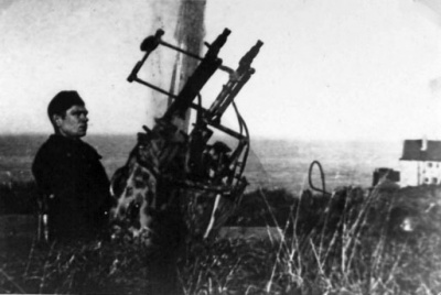
 An anti-aircraft gun at Wiederstandnest Jasmin, on the clifftop between Bonne Nuit and Bouley Bay
 -
 Anti-tank defences at WN Jasmin
 -
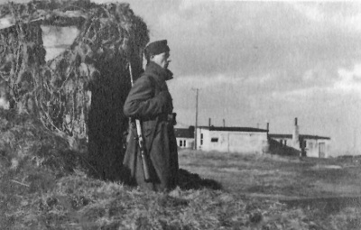
 Day accommodation for the two NCOs and ten men who manned WN Jasmin
 -
 Exploring the cliffs at WN Jasmin was not recommended
 -
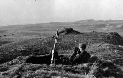
 A signal post at WN Jasmin
 -
 Jasmin's well
 -
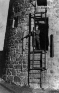
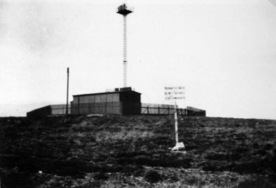 A communications centre at Jersey's highest point at Les Platons, used in later years by the BBC to receive television transmissions from England
 -
 A tank turret protecting Les Platons installations


![La Crete Fort, [13] in the middle of Bonne Nuit Bay, was built in 1834 as protection against a French invasion. The Germans adapted it for their own use as a small resistance nest, manned by one NCOs and six men [14]](/wiki/File:SJ23GreenBookLaCreteFort.jpg)
![A defence position at Bonne Nuit [15]](/wiki/File:SJ23GreenBookBonneNuitDefencePosition.jpg)


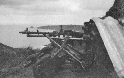
Bouley Bay was the most protected area of the north coast. There was a Stutzpunkt in the bay itself, manned by a officer, three NCOs and 15 men [16]; Wiederstandnest Oben on the cliff above, manned by one NCO and 14 men; and a further wiederstandnest at the top of the hill where the Bouley Bay Hotel then stood, manned by two NCOs and six men
-
 Bouley Bay is to the right of this aerial reconnaisance photograph
 -
 An anti-aircraft gun on the clifftop above Bouley Bay
 -
 The well defended jetty at Bouley Bay
 -
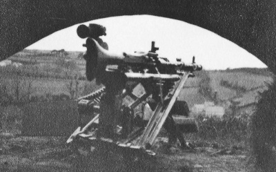
 A 3.7cm gun guarding the harbour at Bouley Bay
 -
 Accommodation for the men of Bouley Bay Oben
 -
 A mortar position at Bouley Bay Oben
 -
 Bouley Bay Hotel
 -
 A machine gun position guarding the hotel
 -
 Another machine gun
 -
 A mortar at the hotel
 -
 A 10.5 cm cannon
 -
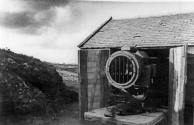
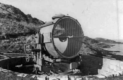
 A searchlight
 -
 a searchlight storage room
 -
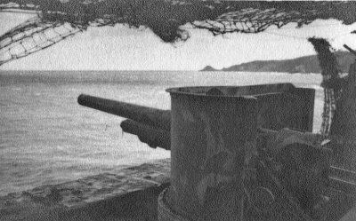
 A gun barrel at the bottom right of this photograph, looking down on Rozel Harbour. It was defended by a wiederstandnest manned by two NCOs and eight men, and a larger installation at the historic Rozel Fort, with a 10.5 cm cannon among its weaponry, and a a complement of four NCOs and 21 men
 -
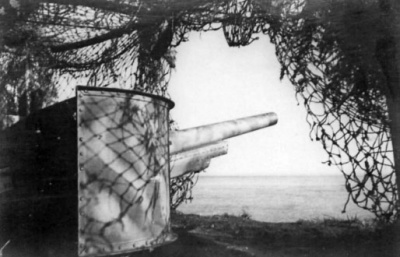 A gun at Rozel Fort
 -
 A Russian conscript at Rozel Fort
 -
 A large searchlight at the fort
 -
 Anti-aircraft gun position on the shoreline, viewed from above
 -
 Another searchlight
 -
 Rozel Harbour
 -
 Rozel Harbour day accommodation


North-east coast

![Heavy artillery defending the breakwater at St Catherine, invariably described correctly by the Germans, as Verclut [17]](/wiki/File:SJ23GreenBookWNMoleVerclut.jpg)
-
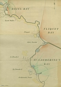
![Fliquet tower, at the north-east corner of the island, was converted by the Germans into a wiederstandnest manned by two NCOs and ten men. It housed a 10.5 cm cannon, not included in any of the Green Book photographs[18]](/w/images/thumb/c/c6/SJ23GreenBookWNFliquetTower.jpg/400px-SJ23GreenBookWNFliquetTower.jpg) Fliquet tower, at the north-east corner of the island, was converted by the Germans into a wiederstandnest manned by two NCOs and ten men. It housed a 10.5 cm cannon, not included in any of the Green Book photographs[18]
Fliquet tower, at the north-east corner of the island, was converted by the Germans into a wiederstandnest manned by two NCOs and ten men. It housed a 10.5 cm cannon, not included in any of the Green Book photographs[18] -
 View towards Fliquet from St Catherine
 -
 The entrance to the tower was well above ground level
 -
 A searchlight at nearby La Coupe
 -
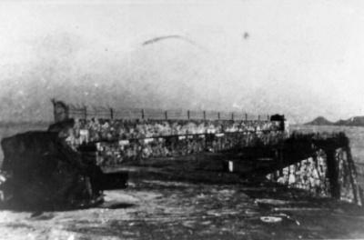
 The structure commonly known today as St Catherine's Breakwater
 -
 A searchlight at St Catherin ...
 -
 ... and another
 -
 Wiederstand Mole Verclut was the German name for the installation guarding the breakwater ...
 -
 ... it was manned by four NCOs and 22 men
 -
 The breakwater
 -
 A 10.5cm cannon was the main armament of Mole Verclut
 -
 This rockface, wrongly known to islanders for years as Gibraltar (that is further south down the coast) housed the Verclut resistance nest
 -
 Verclut gun emplacement
 -
 Machine gun at Verclut
 -
 An aerial view of this part of the coast ...
 -
 ... and a corresponding map
 -
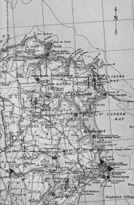
 A hand-drawn map showing the location of defensive installations at the north-east of the island
 -
 Wiederstandnest La Perrelle, between St Catherine and Archirondel, was split into two sections, manned in total by five NCOs and 24 men. This structure housed a 4.7cm anti-aircraft gun
 -
 Daytime accommodation at La Perrelle
 -
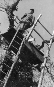 A sentry up a tree (don't ask why!) at La Perrelle
 -
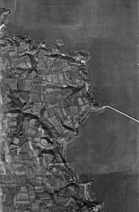
 Aerial view of WN Archirondel, manned by one officer, two NCOs and 15 Men
 -
 Archirondel tower
 -
 Archirondel tower with a turret gun alongside
 -
 Soldiers outside their billet - Archirondel Cottage
 -
 Day accommodation at Archirondel
 -
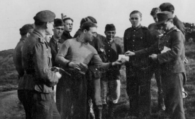
 Tank traps at Archirondel, which were photographed being removed by German prisoners of war after the Liberation
 -
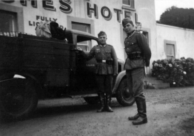 Les Arches Hotel, also commandeered by the Germans
 -
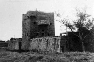
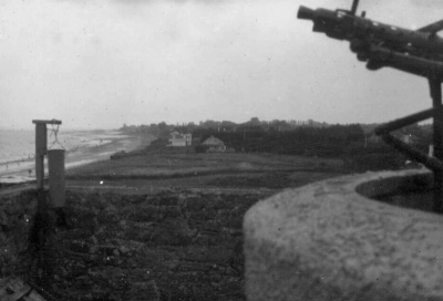
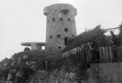
 Victoria Tower, inland and higher up from Gorey, was variously manned by up to four NCOs and 36 men. It was a very well armed resistance nest, commanding extensive views of the northern end of the east coast
 -
 Victoria Tower
 -
 Victoria Tower, disguised as a summerhouse
![Fliquet tower, at the north-east corner of the island, was converted by the Germans into a wiederstandnest manned by two NCOs and ten men. It housed a 10.5 cm cannon, not included in any of the Green Book photographs[18]](/wiki/File:SJ23GreenBookWNFliquetTower.jpg)


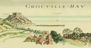
Grouville Bay


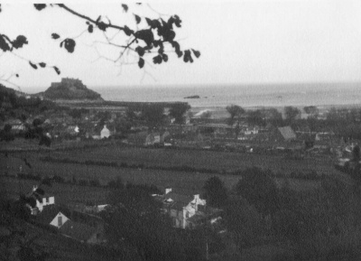
The long stretch of sandy bay down the east coast from Gorey [19] to La Rocque was seen as a potential landing point for any attempt to retake the island and was heavily defended. Several of the coastal defences constructed during the era of the Napoleonic wars in the 18th and 19th centuries were adapted by the Germans for 20th century warfare. Other installations away from the coast are covered in the inland section further down this page
-
 A map of the bay ...
 -
 ... and the corresponding aerial view
 -
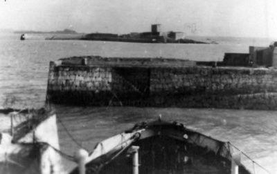
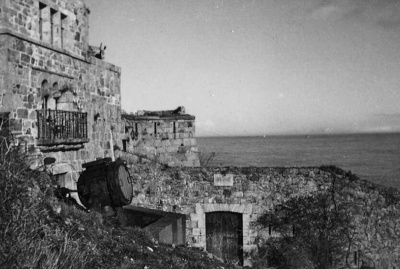
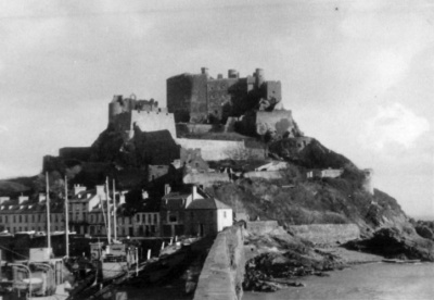 Mont Orgueil at Gorey. The port was defended by Wiederstandnest Hafen Gorey and a second installation in the castle itself. The harbour unit was manned by two NCOs and up to 21 men
 -
 No bunker in this 1943 photograph
 -
 The bunker under construction in 1944 - the last major German coastal installation to be completed, doubtless after attacks from France were anticipated following D-Day
 -
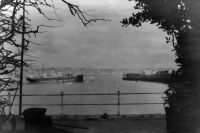
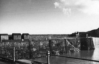
 Evening Post ground level photographs from 1945 and 1946 showing the seaside bunker ...
 -
-
-
-
 A machine gun post overlooking Gorey Village
 -
 Gorey Pier
 -
 Mont Orgueil 'alterations' seen in 1946
 -
 Tank traps on the Grouville Bay coastline with Gorey in the background
 -
 Gorey Harbour
 -
 Gorey Harbour
 -
 Gorey Harbour
 -
 Gorey Harbour
 -
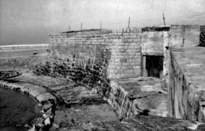
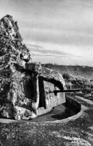
![Fort Henry, the first 18th century installation south of Gorey, was much altered and heavily defended. It was manned by an officer, three NCOs and 32 men [20]](/w/images/thumb/6/6c/GB21FortHenryBunker.jpg/400px-GB21FortHenryBunker.jpg) Fort Henry, the first 18th century installation south of Gorey, was much altered and heavily defended. It was manned by an officer, three NCOs and 32 men [20]
Fort Henry, the first 18th century installation south of Gorey, was much altered and heavily defended. It was manned by an officer, three NCOs and 32 men [20] -
 The entrance to one of the new casemates built by the Germans around Fort Henry on Grouville Common ...
 -
 ... another view of the casemate
 -
 ... and the view from the beach
 -
 A searchlight platform was built on the fort itself
 -
 Fort Henry is a few metres from the shore on Grouville Common: the view northwards to Mont Orgueil ...
 -
 ... and south to La Rocque
 -
 Various views of Fort Henry ...
 -
-
-
 Tank traps
 -
 Day accommodation
 -
 The view across Grouville Common
 -
 Nearby Grouville Arsenal was used to accommodate troops
 -
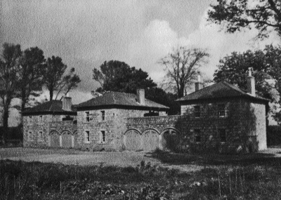
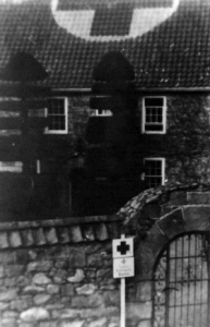
 Grouville Court, a house with 14th century origins and one of the oldest properties in the parish, was commandeered for use as a casualty reception centre named Breslau by the Germans
 -
 Tank traps on the beach
 -
 A view of the coast from out at sea
 -
![Le Hurel was one of the coastal towers taken over by the Germans ... [21]](/w/images/thumb/4/43/SJ23GreenBookLeHurel1.jpg/400px-SJ23GreenBookLeHurel1.jpg) Le Hurel was one of the coastal towers taken over by the Germans ... [21]
Le Hurel was one of the coastal towers taken over by the Germans ... [21] -
-


![Fort Henry, the first 18th century installation south of Gorey, was much altered and heavily defended. It was manned by an officer, three NCOs and 32 men [20]](/wiki/File:GB21FortHenryBunker.jpg)


![Le Hurel was one of the coastal towers taken over by the Germans ... [21]](/wiki/File:SJ23GreenBookLeHurel1.jpg)


South-east coast


-
 Aerial view of St Clement's Bay and La Rocque ...
 -
 ... and the corresponding map
 -
 A hand-drawn map of La Rocque
 -
![La Rocque point is dominated by a coastal tower and the 19th century property Rocqueberg. There were two resistance nests here, designated La Rocque A and La Rocque B [22]. They were manned, respectively, by four NCOs and 19 men, and two NCOs and 14 men](/w/images/thumb/2/2c/SJ23GreenBookWNLaRocqueA1.jpg/400px-SJ23GreenBookWNLaRocqueA1.jpg) La Rocque point is dominated by a coastal tower and the 19th century property Rocqueberg. There were two resistance nests here, designated La Rocque A and La Rocque B [22]. They were manned, respectively, by four NCOs and 19 men, and two NCOs and 14 men
La Rocque point is dominated by a coastal tower and the 19th century property Rocqueberg. There were two resistance nests here, designated La Rocque A and La Rocque B [22]. They were manned, respectively, by four NCOs and 19 men, and two NCOs and 14 men -
 La Rocque from the sea
 -
 La Rocque viewed from the tower
 -
 Day accommodation
 -
 Rocqueberg
 -
 The tower's well
 -
 View of the La Rocque coastline from the sea
 -
 A searchlight stand
 -
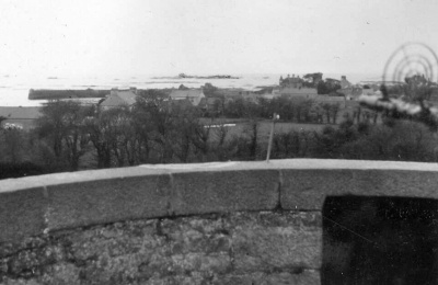 A gunner's view from the top of the tower
 -
 A turret gun defended the approach to La Rocque along the coast road
 -
 A searchlight
 -
 A 10.5cm gun
 -
 Seymour Tower viewed from inland
 -
 The coast to the west of La Rocque
 -
 St Clement's Church viewed from the sea
 -
 A view from Mont Ube light
 -
 Eastwards from Nicolle Tower
 -
![Einsatzstellung Le Hocq, one of two photographs in the St Clement Green Book, which gives no details of the installation [23]](/w/images/thumb/0/08/SJ23GreenBookEinsatzstellungLeHocq1.jpg/248px-SJ23GreenBookEinsatzstellungLeHocq1.jpg) Einsatzstellung Le Hocq, one of two photographs in the St Clement Green Book, which gives no details of the installation [23]
Einsatzstellung Le Hocq, one of two photographs in the St Clement Green Book, which gives no details of the installation [23] -
 Einsatzstellung Le Hocq, the second photograph


![La Rocque point is dominated by a coastal tower and the 19th century property Rocqueberg. There were two resistance nests here, designated La Rocque A and La Rocque B [22]. They were manned, respectively, by four NCOs and 19 men, and two NCOs and 14 men](/wiki/File:SJ23GreenBookWNLaRocqueA1.jpg)


![Einsatzstellung Le Hocq, one of two photographs in the St Clement Green Book, which gives no details of the installation [23]](/wiki/File:SJ23GreenBookEinsatzstellungLeHocq1.jpg)

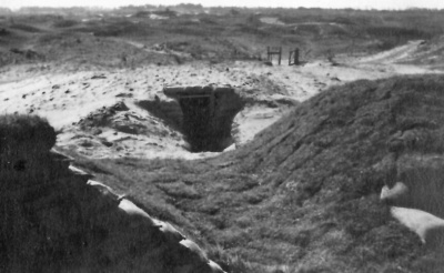
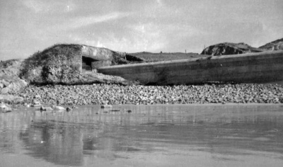
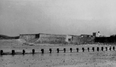
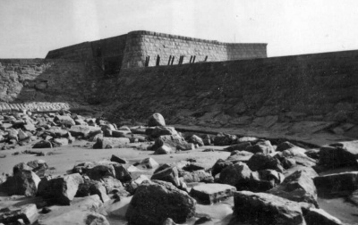
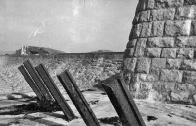
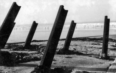
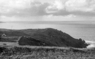
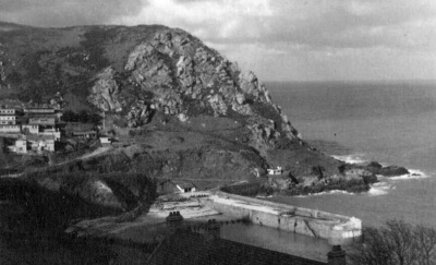
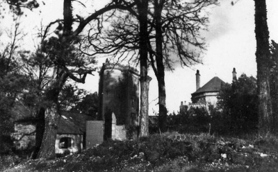
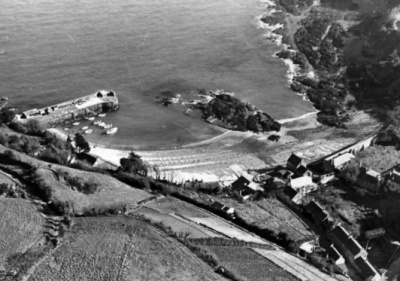
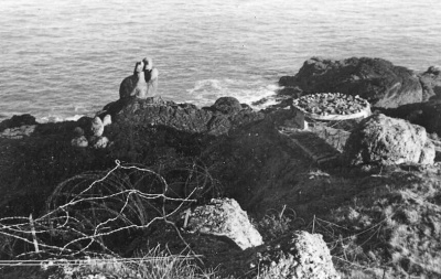
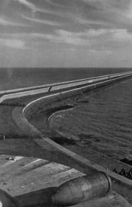
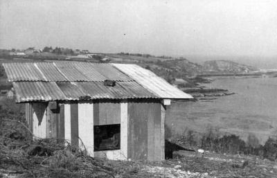
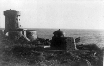
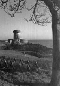
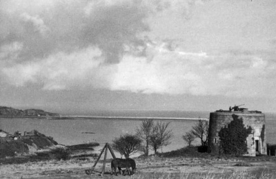
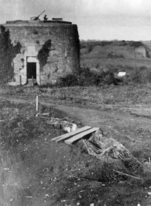
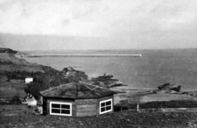
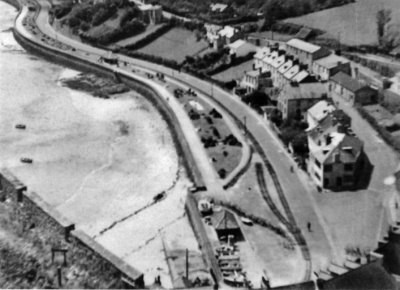
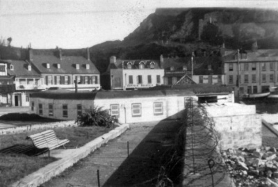
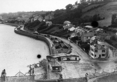
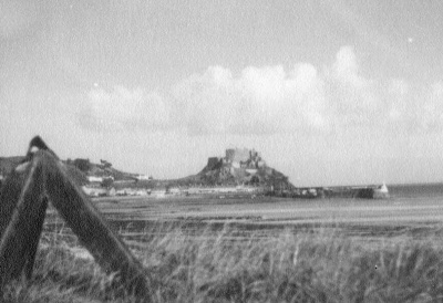
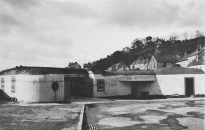
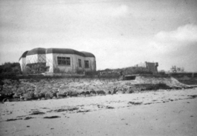
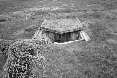
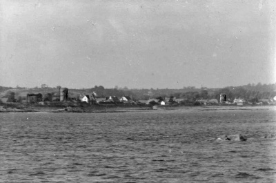
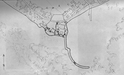
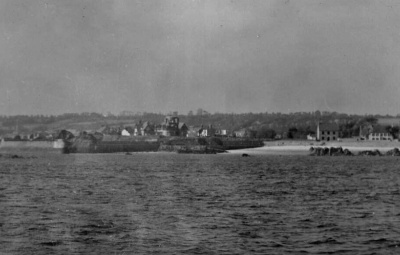
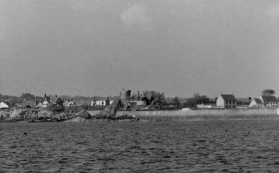
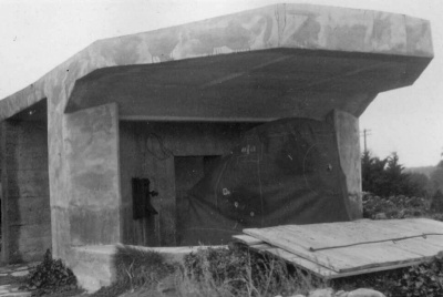
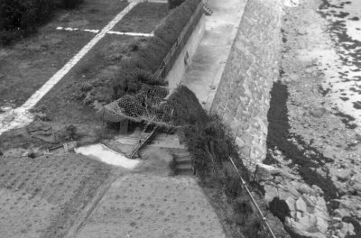
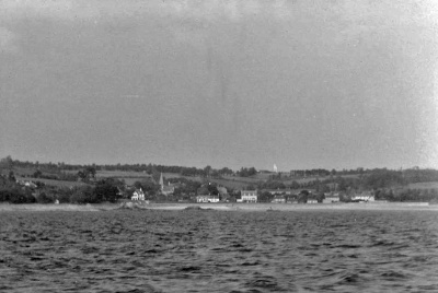
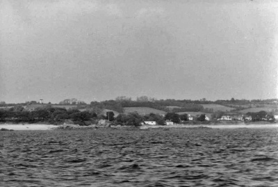
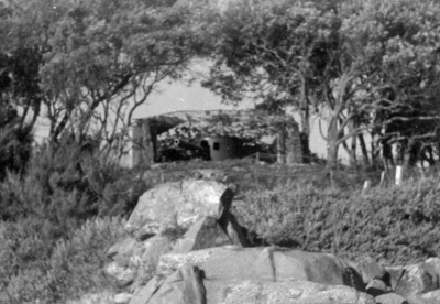
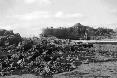
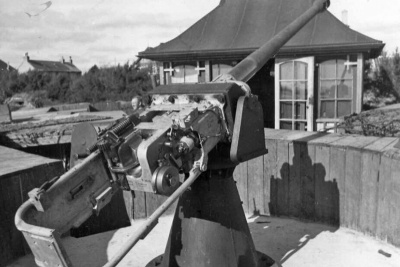
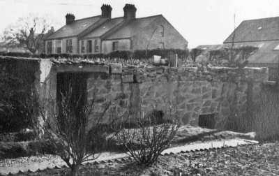
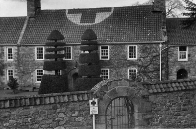
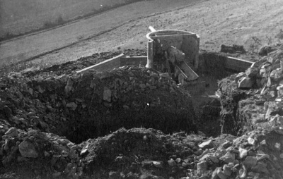
La Motte

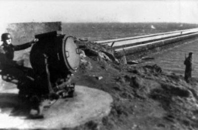
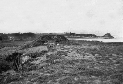
What islanders now universally call Green Island was given its original name of La Motte by the Germans, who built a resistance nest there, manned by an officer, three NCOs and 21 men
-
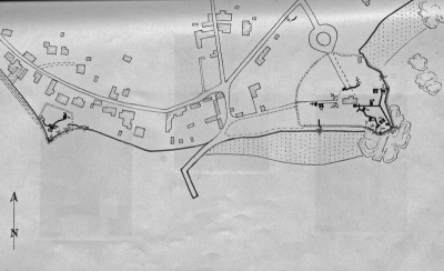 Map of Wiederstandnest La Motte
 -
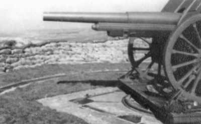
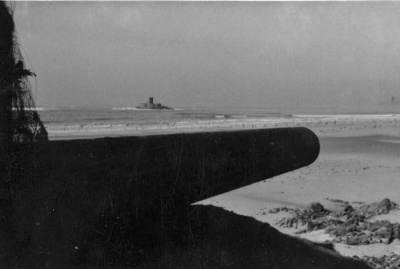
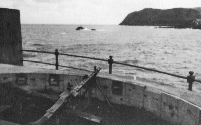
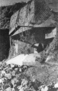
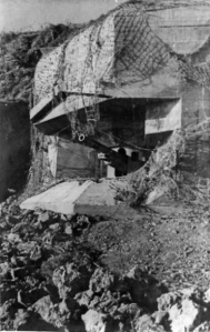
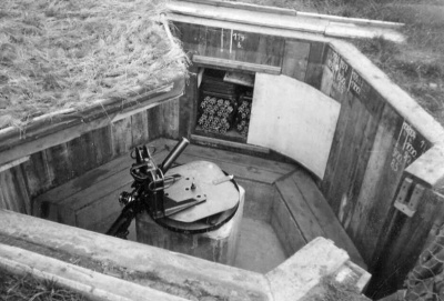
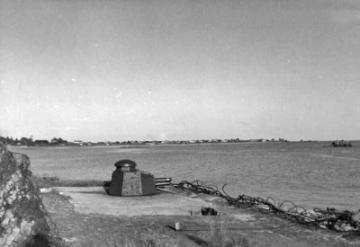
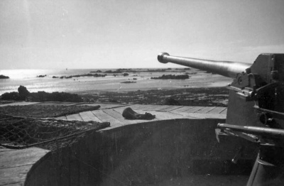 This gun at La Motte covered a wide sweep of St Clement's Bay
 -
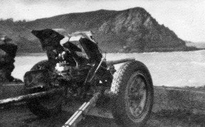
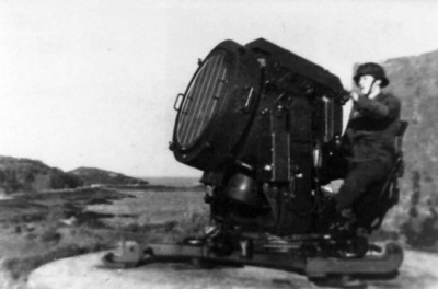
 10.5cm gun at La Motte ...
 -
 ... the gun position ...
 -
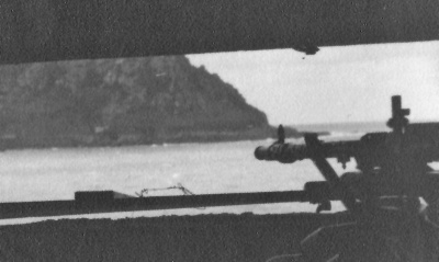
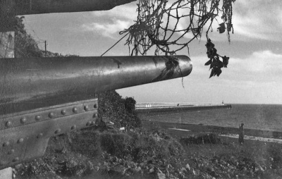
 ... the gun viewed from the sea
 -
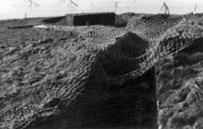
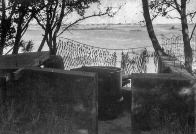
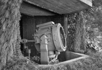 La Motte searchlight
 -
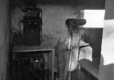 La Motte command post
 -
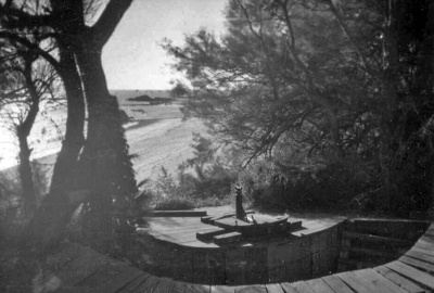
 Day accommodation at La Motte
 -
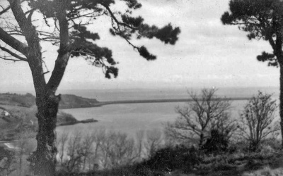
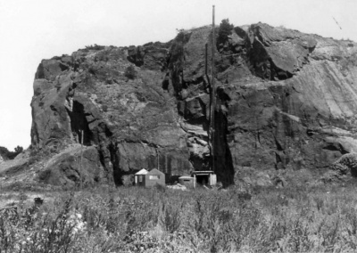
 View from the south-east
 -
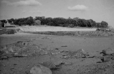 View from the south-west
 -
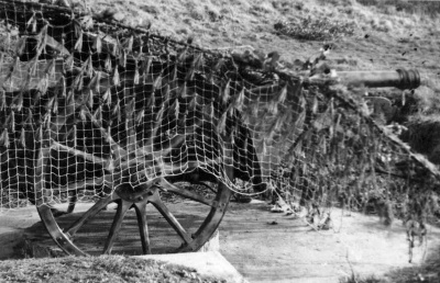
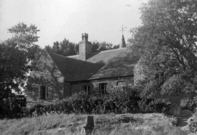
 This gun was positioned in a garden in front of a summerhouse


Inland locations
This section of our gallery covers various inland locations, mainly in the east and west of the island
-
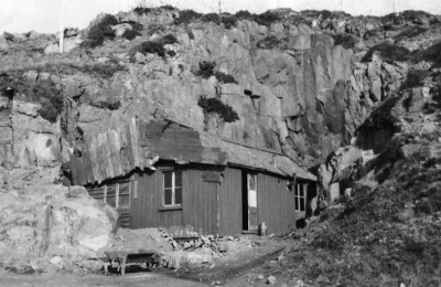
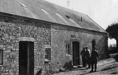
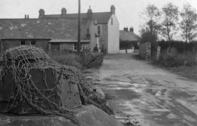
 The Alexandra Hotel in St Peter's Village, was fortified for military use
 -
 Part of the St Peter resistance nest
 -
 Oak Walk, a 19th cen tury cottage ornee was requisitioned for troop accommodation ...
 -
 ... as was this nearby house
 -
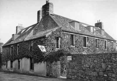
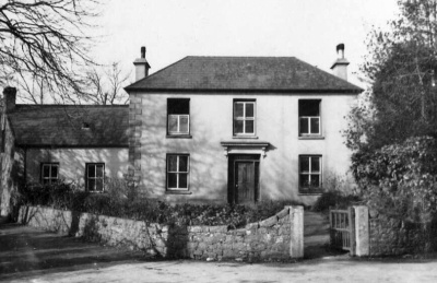
 Maison Maret, a house next to Trinity Church with 16th century origins, was used as a casualty receiving station
 -
 Maison Maret
 -
 Maison Maret
 -
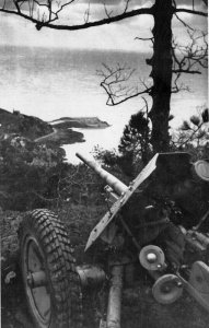
 A field gun near St Martin's Church
 -
 An artillery installation in a Grouville cotil
 -
 Grouville Mill had a section added at the top for military use
 -
-
 Wiederstandnest 190 commanded the area from Gorey to Fort Henry
 -
 WN 190 was manned by one NCO and 12 men
 -
 WN 190 operated in conjunction with WN 212
 -
 Wiederstandnest 212, inland from Gorey, was manned by one NCO and ten men
 -
 WN 212 commanded the flat area below from Gorey and Fort Henry
 -
 WN 212 was mainly a machine gun position, working in conjunction with WN 190
 -
 Wiederstandnest Woodlands was an inland anti-aircraft position
 -
 WN Woodlands
 -
 WN Woodlands' 7.5cm anti-aircraft gun


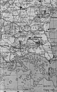
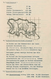
Overall statistics etc
The ninth Green Book owned by La Société Jersiaise, Taktische Ubersichten contains illustrated statistics of the strength of the German military in Jersey throughout the Occupation, including a number of maps never published elsewhere

-

-
-
-
-
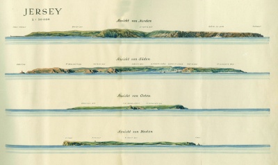 Drawing of the island's coasts, seen from the sea, north, south, east and west
 -
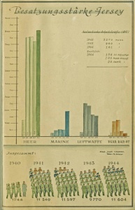 Troop numbers 1940-1944: Army, navy, Luftwaffe and Organisation Todt
 -
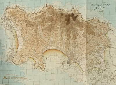 Three maps showing the island's topography ...
 -
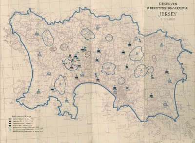 ... Bereitstellungsraume (staging positions) ...
 -
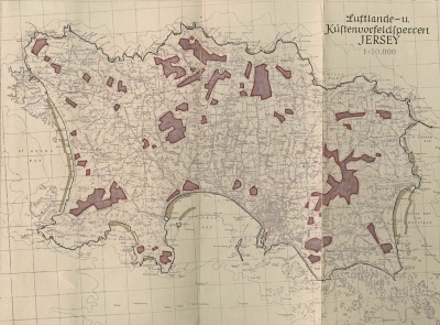 ... and Luftlande und Kustenvorfeldsperren (installations giving protection from air and coastal attacks)


Notes and references
- ↑ The two albums can be viewed here by subscribers to the Archive online catalogue
- ↑ We have deliberately chosen to create a single, large gallery, because this is the first time that these two important collections of photographs have been assembled in one place
- ↑ A small number of images included here may not be from either collection but are pictures taken during the Occupation by the Germans for other purposes. There are also a few post-Liberation photographs which are clearly identified as such
- ↑ Today's view of the Victoria Pier installation from bunkersite.com and Further modern pictures of harbour installations
- ↑ Today's pictures of West Park installations in the website bunkersite.com
- ↑ Pictures from bunkersite.com of installations in the bay in the 21st century
- ↑ Today surfers gather there, as shown in these pictures in bunkersite.com
- ↑ Modern pictures of the restored La Mare Mill resistance nest, from bunkersite.com
- ↑ The bunkers remain sealed. Recent pictures of the Plemont strongpoint
- ↑ 21st century pictures of Greve de Lecqfrom bunkersite.com
- ↑ Today's pictures of Sorel A from bunkersite.com
- ↑ Today's pictures of Sorel B from bunkersite.com
- ↑ Today's pictures of La Crete Fort from bunkersite.com
- ↑ Today the fort is used as a holiday let, administered by Jersey Heritage. In the 1920s it was leased to Jimmy Rimington, a fruiter and florist at No 13 King Street, and grandfather of Jerripedia editor Mike Bisson, whose mother used to enjoy family weekends there
- ↑ Today's pictures of Bonne Nuit harbour from bunkersite.com
- ↑ Today's pictures from bunkersite.com of a bunker at Bouley Bay harbour converted to a summerhouse
- ↑ Today's pictures of WN Verclut from bunkersite.com
- ↑ Today's pictures of WN Fliquet from bunkersite.com
- ↑ Today's pictures of Gorey defences from bunkersite.com
- ↑ Today's pictures of Fort Henry from bunkersite.com
- ↑ Today's pictures of Le Hurel from bunkersite.com
- ↑ Today's pictures of La Rocque A from bunkersite.com and La Rocque B
- ↑ Today's views of Le Hocq from bunkersite.com
