The La Collette land reclamation scheme of the 1970s in pictures

In 1973 Jersey embarked on the first major land reclamation scheme since the coastline of St Helier was extended to encompass the area now known as the Weighbridge some two centuries earlier. The La Collete land reclamation scheme, as it was known, would provide a modern berth for tankers bringing petroleum and other liquid fuels to the island, the first of what would become a succession of yacht marinas to cope with the growing demand for moorings for visiting leisure craft, and a large land area for liquid and gas fuel tanks, as well as miscellaneous commercial activities.
The picture gallery below shows how this reclamation scheme progressed month by month, and succeeded where a somewhat similar scheme to provide St Helier with a deep-water harbour had failed in the 1870s.
-
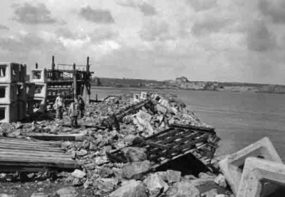
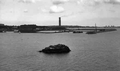
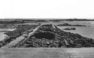 June 1973 - the remains of the failed 1870s pier
 -
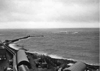
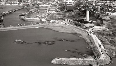
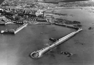
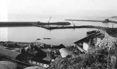
 June 1973 - a view of the La Collette area before work started
 -
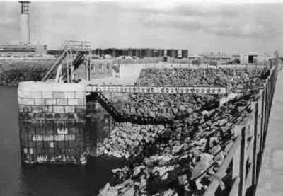
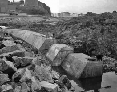 July 1973 - the start of the toe wall which will support the 'cobs', hollow concrete cubes which will form the outer face of the new sea wall and absorb wave energy
 -
 July 1973 - The toe wall joins the stub of the 1870s pier
 -
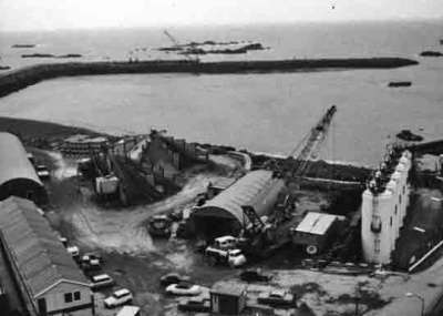
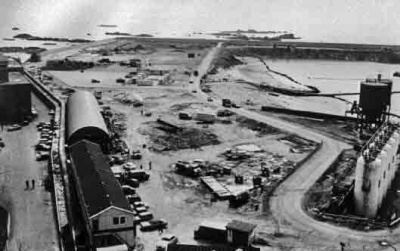
 July 1973 - Increasing activity on the La Collette shore
 -
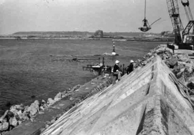
 July 1973 - A crane is erected to manoeuvre the cobs into place
 -
 July 1973 - A rubble wall is created ready to take the first rows of cobs
 -
 October 1973 - The first cobs are in place as winter approaches
 -
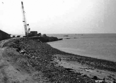
 November 1973 - The new sea wall stretches out beyond where the 1870s project failed
 -
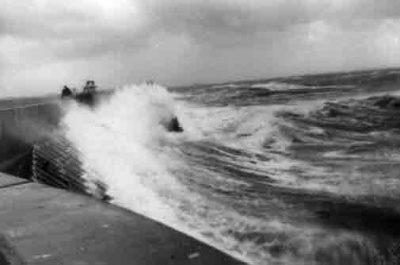
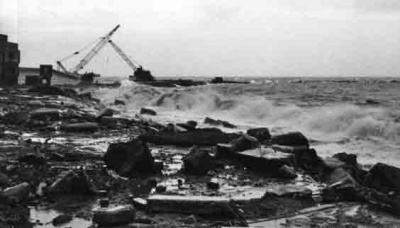 January 1974 - winter storms batter the new construction
 -
 January 1974 - work continues on building the wall of cobs
 -
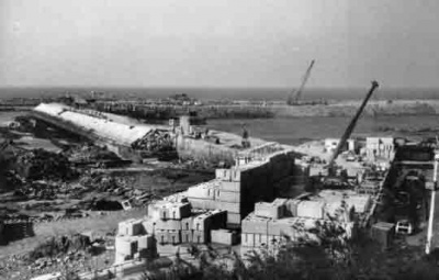
 March 1974 - eight months into the project and the wall turns the corner
 -
 Another view from the same Jersey Evening Post set in March 1974
 -
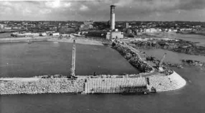
 July 1974 - a year has passed and the wall is extending rapidly
 -
 September 1974 - autumn gales damage the wall and cause delays
 -
 September 1974 - unsecured cobs are moved by the power of the sea
 -
 October 1974 - but this is only a temporary setback and the wall grows
 -
 October 1974 - Work continues as the autumn storms abate
 -
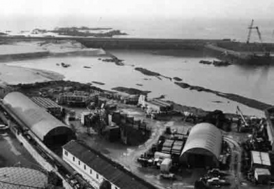
 December 1974 - 17 months into the project and contrast this view with earlier pictures from the same position
 -
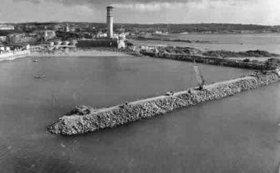
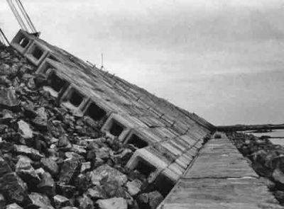
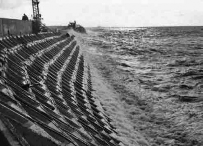
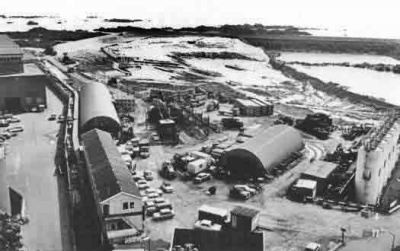
 March 1975 - a tall wall is needed with Jersey's 40-foot tidal range
 -
 May 1975
 -
 May 1975
 -
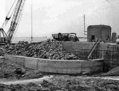
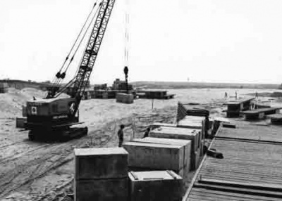
 May 1975 - Continuing the toe wall
 -
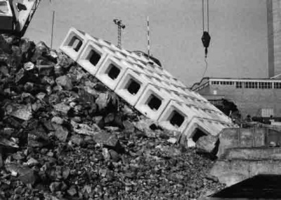
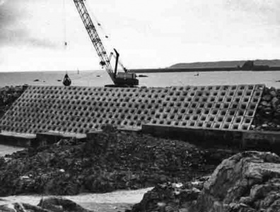
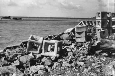
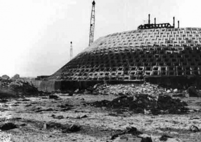
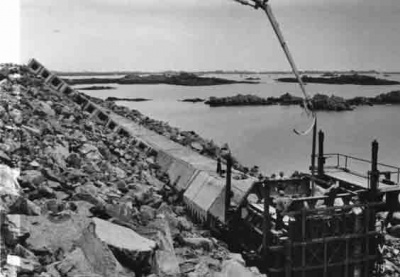
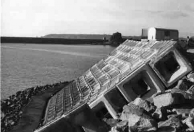
 May 1975 - the cobs sit on the toe wall and are held in place by their weight. The honeycomb network dissipates the force of waves
 -
 September 1975
 -
 January 1976
 -
 February 1976
 -
 May 1976
 -
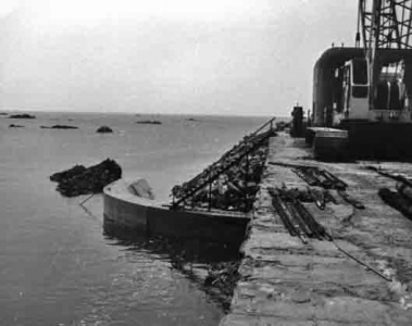
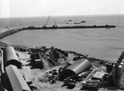
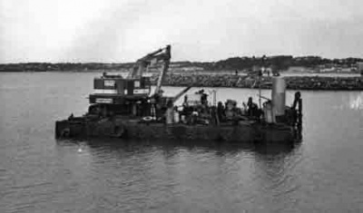
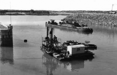
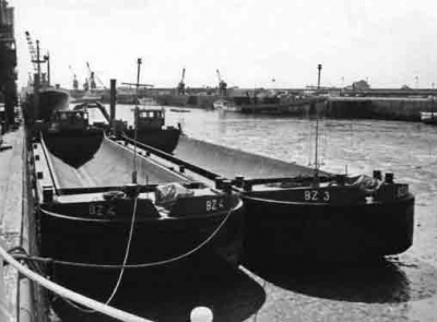 May 1976 - Dredging barges
 -
 July 1976
 -
 July 1976
 -
 September 1976
 -
 October 1976 - Gale force 9
 -
 October 1976 - Storm force 12
 -
 December 1976
 -
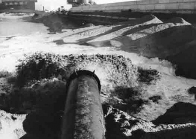 February 1977 and sand is pumped into the site
 -
 March 1977
 -
 April 1977
 -
 July 1977
 -
 August 1977
 -
 August 1977
 -
 August 1977
 -
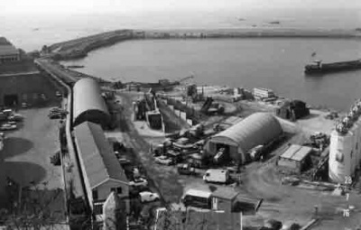
 February 1978
 -
 April 1978
 -
 April 1978
 -
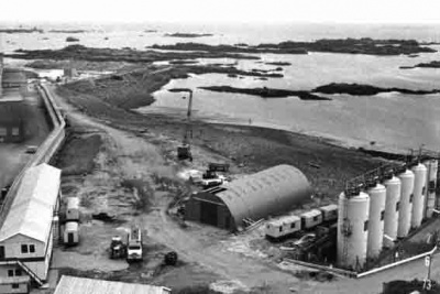
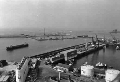
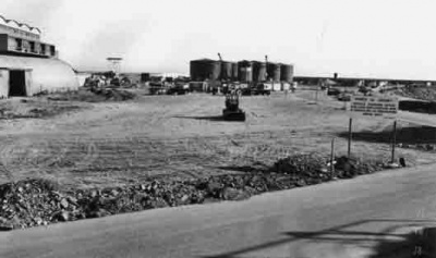 August 1978
 -
 August 1978
 -
 August 1978
 -
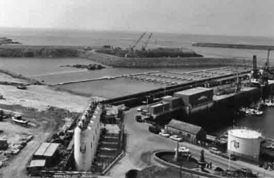
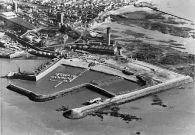
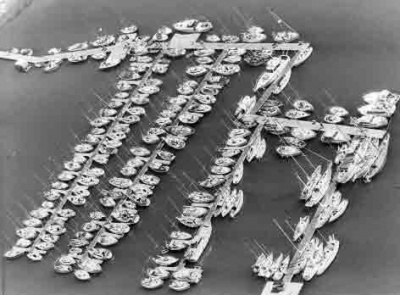 The marina pontoons
 -
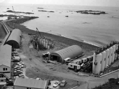
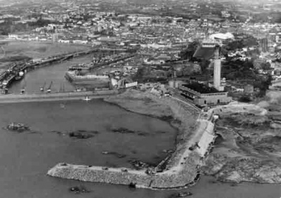
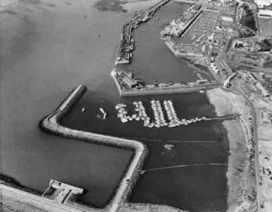 The retaining walls completed and marina pontoons installed


- See A collection of aerial photographs of Jersey from 1945 to 1979 and A collection of aerial photographs of Jersey from the 1980s and 1990s for more aerial photographs of the land reclamation area
