Fliquet Tower

Fliquet Tower

Fliquet Tower is the most northerly of the line along Jersey's east coast. It is owned by the States of Jersey. This poor quality image was previously thought to be a photograph, but close examination suggests that it is a drawing. It it is the only known picture of the tower with its upper section intact

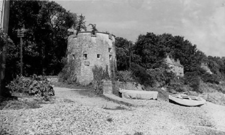
Fliquet Tower [1] is also known as Telegraph Tower, because an undersea telegraph cable to France came ashore here. It stands on the coast at the northern end of Fliquet Bay, on a stretch of road known as Le R'Volu, between Rue de la Perruque and Rue de Fliquet.
It was originally intended that there would be a further tower extending the east coast chain to Rozel, but permission was not given to Jersey's Governor, General (later Field Marshal) Henry Seymour Conway, who was horrified at the state of Jersey's defences when he first came to the island in 1778, six years after his appointment.
This Conway tower was completed in 1781. In 1797 it was manned by a sergeant, corporal and ten men of the Invalids Battalion. In 1803 it was manned by a sergeant, corporal and nine men of the 3rd Royal Garrison Battalion. It received a new roof in 1812. It was repaired in 1833, and again in 1835.
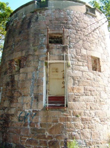
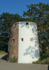
It was armed with the usual 18pdr carronade on the roof and the nearby battery had a 24pdr. It had a magazine for 20 barrels of powder. At some stage during the 19th century the top floor was removed straight through the line of the musket loops, leaving a ‘new’ top to the tower.
During WWII it was manned by two NCOs and ten other ranks. A number of fortifications surrounded it.
HER statement
Along with all Jersey's other coastal towers and historic fortifications it is a listed building, described as follows in the Jersey Heritage Historic Environment Record website:
- "One of 23 Conway towers built between 1778 and 1801, adapted into integrated network of German defensive structures constructed in Jersey during the Second World War, more widely part of the Atlantic Wall.
- "Remains of Conway Tower circa 1794. Shown on 1795 Richmond Map. The tower lost its original upper section at some time before 1910, when the section of the tower above the cill level of the second floor loopholes was removed and the remaining lower portion of the tower topped with ornamental crenellations.
- "Adapted by German occupying forces during the Second World War, and partially capped with a concrete roof. Adjoining machine gun positions, personnel shelter and open position for 10.5cm beach defence added as part of Resistance Nest Fliquet.
- "Round tower in random granite, with lower circuit of gun loopholes dressed in brick and granite."

-
-
-
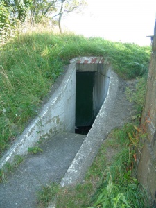 The entrance to the German bunker built alongside the tower


-
-
-
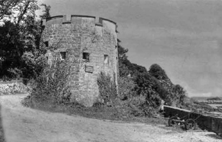
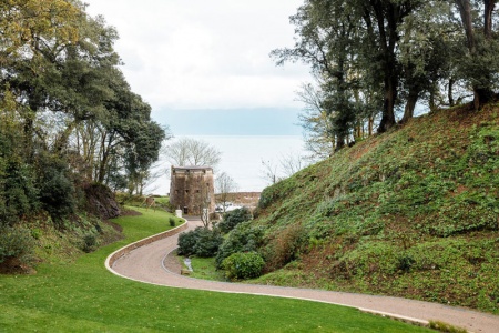 The tower viewed from the drive to the property above known as Cedar Valley


German Occupation pictures and maps


Notes and references
- ↑ The name of the bay in which the tower was built is variously spelt Fliquet and Flicquet
