St Helier picture gallery
From Jerripedia
Jump to navigationJump to search

St Helier picture gallery

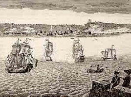
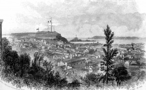
An impression of St Helier in the 16th century. Unless a large number of these buildings were demolished and the town's layout subsequently changed dramatically, it is unlikely that it actually looked anything like this

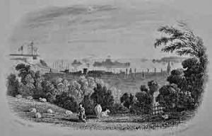
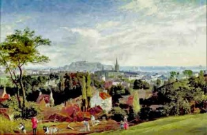
This enlargement of a section of a painting of St Helier, viewed from the west, by George Heriot, dated 1790, is believed to give a much better impression of what the town was like at the time. Shortly after this a dramatic population growth saw the town expand considerably. This painting is in the collection of the British Library

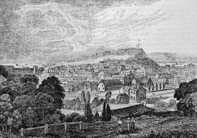
Another artist's impression of a section of 18th century St Helier. The drawing seems to display a considerable degree of artistic licence. It is possible that the church on a hillside on the left is meant to be St Saviour's Parish Church, rather than the town church, which was on the shoreline

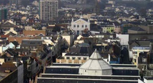
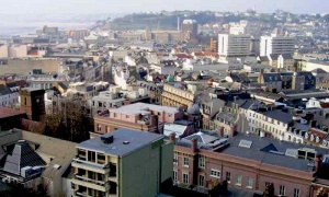
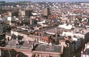
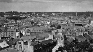
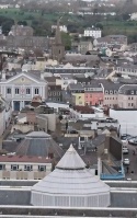
The town viewed from Fort Regent in September 2025. The striking steel and glass dome in the foreground is part of Morier House, the States offices for legal departments. This structure is not visible from street level

This gallery shows general pictures of St Helier. Pictures of individual streets and districts and the Harbour will be found on other pages. See also One hundred views of St Helier, a personal view of the town and some of its older buildings. Click on image to see larger picture
-
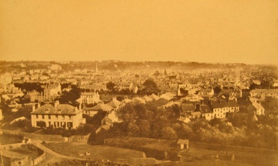
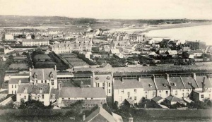
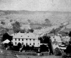
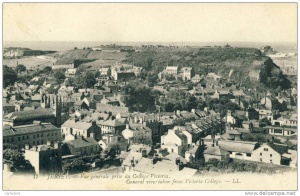
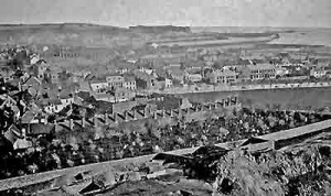
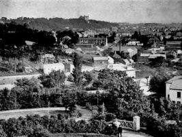
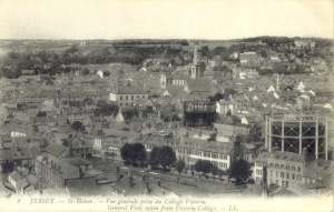
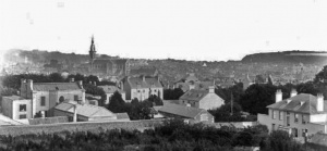
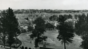
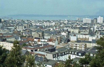 St Helier viewed from Victoria College in the 1970s
 -
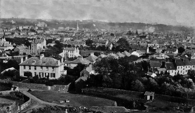
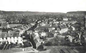
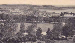
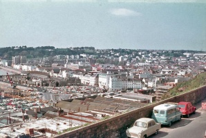
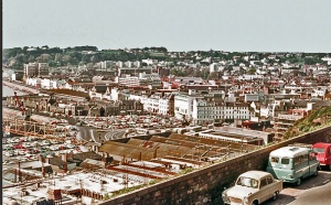
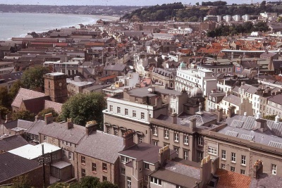 A view over the town in 1968
 -
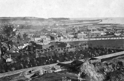
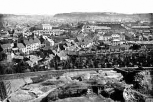
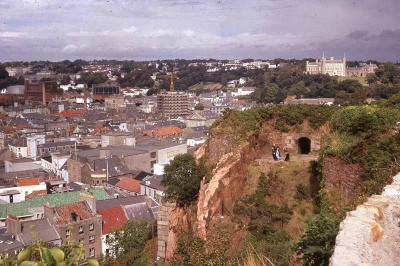 St Helier viewed from Fort Regent
 -
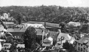
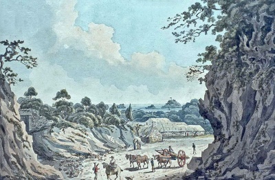 Town Mills in 1789
 -
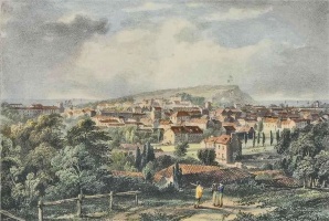
 'St Hillary'
 -
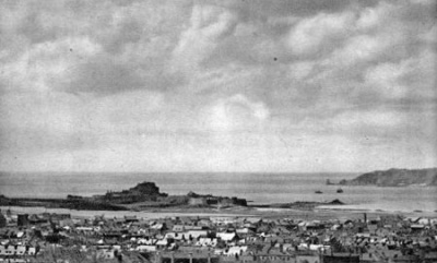
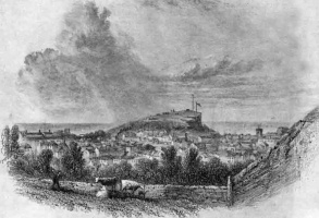
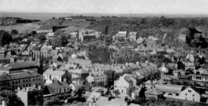
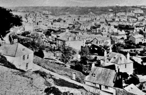
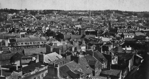
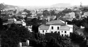
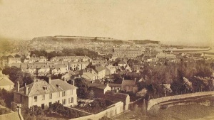
 View over the town in 1880
 -
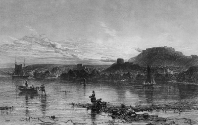 This is St Helier, viewed from the sea in 1868 - or is it? That's the description which came with the picture in 2016, although it did not look much like St Helier. Now we are are told that it is from a book of 1786 views around the British Isles. Further research suggests that the engraving, a print from which is in the British Museum, was made in 1868 from an earlier drawing by Clint (presumably George Clint, who lived from 1770 to 1854). It still does not look much like St Helier and we are investigating further.
 -
 1880s
1880s -
 1940s
1940s -
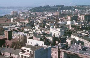
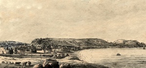
 View over St Helier from the west
 -
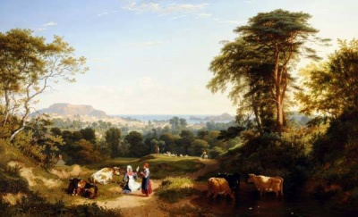 An 1833 painting by P H Rogers
 -
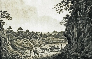
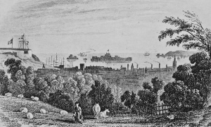
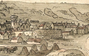
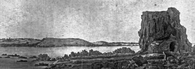 Hermitage, 1789


View from Fort Regent in 2021

And looking in the opposite direction in about 1806 - a sketch by Henry Irwin
-
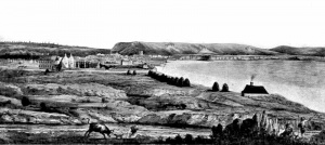
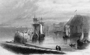
 An early engraving of the view from the sea
 -
 Heriot painting from 1789
 -
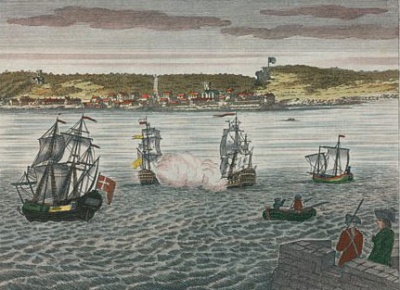
 Heath painting from 1757
 -
 Town Mills, 1789
 -
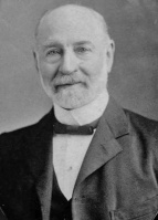 Long-serving town secretary Capt Thomas Le Seelleur
 -
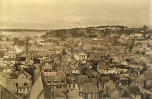
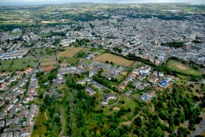
 St Luke's District viewed from Fort Regent
 -
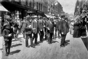
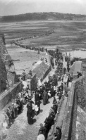 St Helier's Day pilgrimage
 -
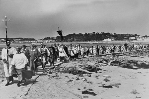 St Helier's Day
 -
 St Helier House
 -
 1880
1880 -
-
 The town viewed from St Thomas' Church
 -
 1856, by G B Willis
 -
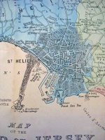
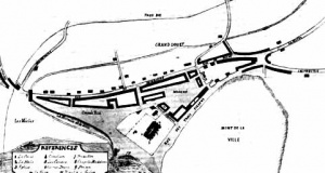
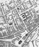
 1691 map
 -
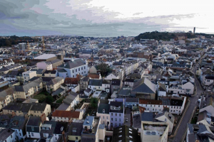 The skyline of a very low-rise town in 2024
 -
 Town rooftops from the west


Despite the banking failures of earlier years almost causing the total collapse of Jersey's financial system, the Parish of St Helier was still issuing its own banknotes in the 1890s ...

... over half a century after this one was issued

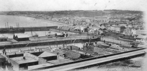
An aerial view of the town, its harbour and Fort Regent in 1960
-
 1865
1865 -
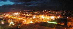 St Helier at night
 -
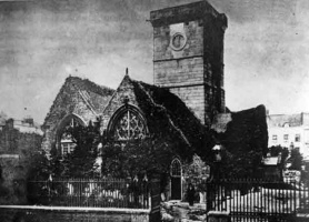 Town Church in the 1860s
 -
 Town Mills in 1893
 -
 Town rooftops
 -
 Town rooftops
 -
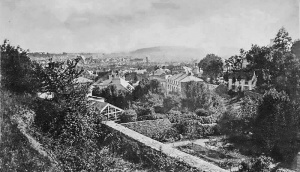
 The town viewed from St Saviour
 -
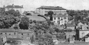
 A view of the town from Victoria College
 -
 A picture captioned 'Town houses and villas and girls school', but which is the school?
 -
-
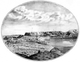 Saint Helier in 1709
 -
-
-
-
 St Helier in 1903
 -
St Helier in 1865
-
 The General Hospital area photographed by Baudoux
 -
 A Baudoux photograph from Westmount in 1875
 -
-
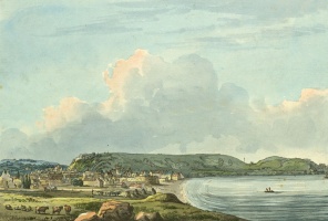
 A view of St Helier in the 1830s painted by Philip Hutchings Rogers
 -
 St Helier in 1879
 -

-
 St Helier from Victoria College
 -
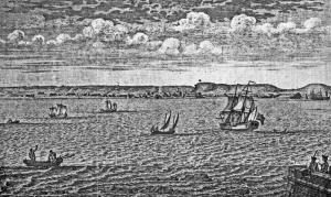
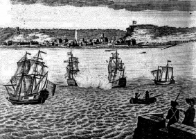
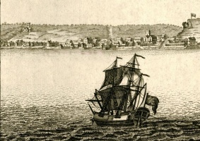
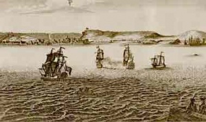 Ships off St Helier
 -
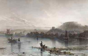
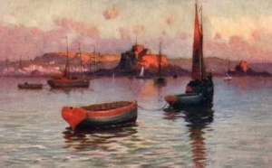 The town from the sea
 -
 A painting by J Heath in 1758
 -
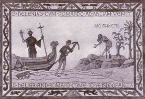 The legend of Saint Helier
 -
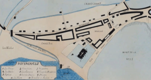
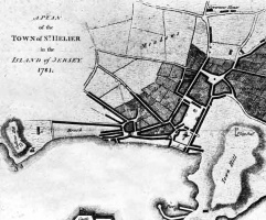 A plan of the small town in 1781


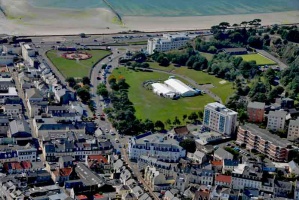
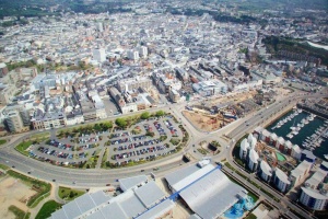
A 2018 drone photograph of St Helier's Waterfront area. The whole of the central area in the picture, including the underpass, is on land reclaimed in the late 20th century
-
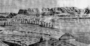
 The town in 1691
 -
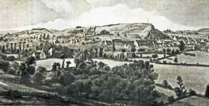
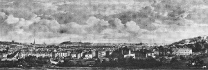
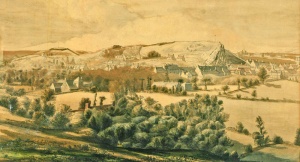
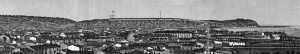
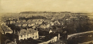
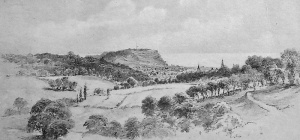
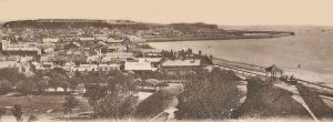 A panoramic view of the town from the west
 -
-
-

-
-
-
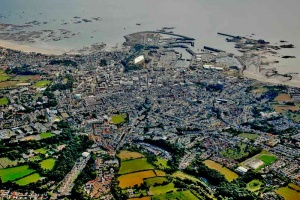
 An aerial view of St Helier in 2011
 -
 A picture from 1834
 -
-
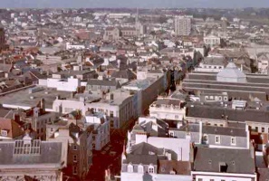
 Town rooftops in 1977
 -
 Town rooftops in 1977
 -
 Town rooftops in 1977
 -
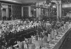 The Royal Hotel dining room ready for a St Helier municipal dinner in 1919
 -
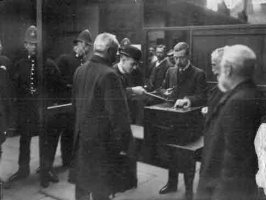 Sealing ballot boxes for a parochial election
 -
 Le Capelain gallery at the Town Hall
 -
 St John's Road with the town behind in the 1890s
 -
 A Visite Royale in 1914
 -
 1901
1901 -
-
-
-
-
-
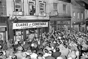 Election for Constable in 1956 - Picture Evening Post
 -
 St Helier visite royale 1896
 -
 'A view of St Hillary'
 -
 A picture of the town by renowned 20th century photographer Francis Firth
 -
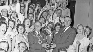 Constable Percy Poingdestre with the BBC Top Town trophy in 1959
 -


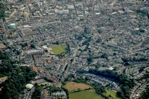
21st century aerial view
-
 St Helier viewed from Fort Regent
 -
 Elizabeth Lane
 -
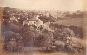
 A view of the town from Trinity Hill in the 1880s, by Ernest Baudoux
 -
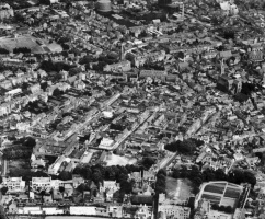 1951 aerial photograph by Aerofilms
 -
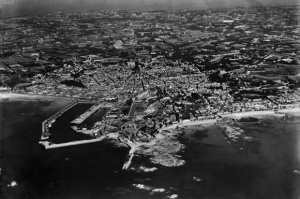 1933 aerial photograph by Aerofilms
 -
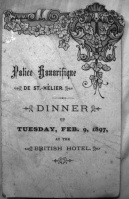 Honorary Police dinner menu
 -
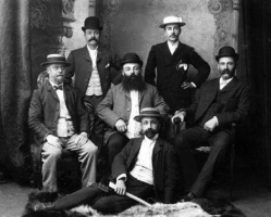
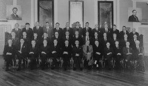
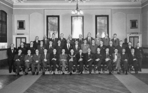 Honorary Police official photograph, 1961
 -
-
 This etching was obtained dated 1836, but it must be significantly earlier because Fort Regent, completed in 1814, has not been built yet
 -
 1853, Philip Ouless
 -
 A drawing of the view from St Saviour
 -
 St Helier House old people's home
 -
 View over St Helier by Francis Frith
 -
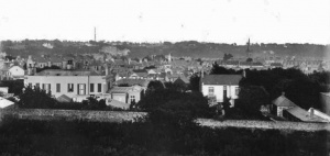
 A view from the west in the 1870s
 -
 A view from Fort Regent. The Weighbridge is at the bottom left
 -
 1772
1772 -
-
-
 1857
1857 -
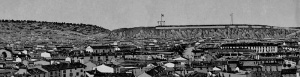
 Aerial view of the west of the town in 1933


The town viewed from the top of St Mark's Church
-
 A view of the town from the west by Asplet and Green
 -
-
 Victoria and Almorah Crescents
 -
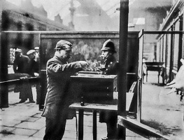 Town Clerk George Le Masurier seals a ballot box for a parish election
 -
 A view from the west
 -
 A view from the west, photographed by Percival Dunham
 -
 A view from the west, photographed by Percival Dunham
 -
 A view from the west, photographed by Percival Dunham
 -
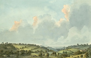 A picture in the British Library entitled 'View from Moulin Pois' 1790
 -
 This picture by George Heriot, of which an enlarged section is shown at the top of the page, was painted by George Heriot in 1790 and is in the British Library
 -
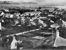
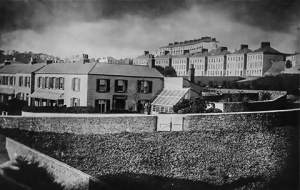
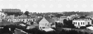
 St Helier's rooftops in 1875, with the Halkett Place market, with its glass dome, in the centre
 -
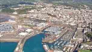
 An aerial photograph of the Waterfront and town behind in the 2000s
 -
 A view of the town from the north in the 18th century
 -
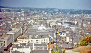
 View of the town from Fort Regent in 1973
 -
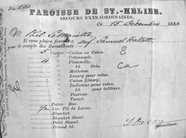 An order for material for a young child - an early form of welfare
 -
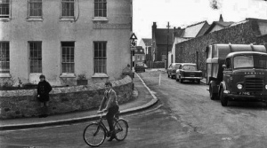
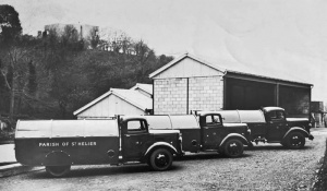 Parish refuse lorries
 -
 Honorary police, 1971
 -
-
 View from Westmount
 -
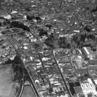
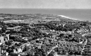 Aerial view of the town and south east of the island in 1940


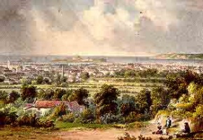
A painting by George Willis of St Helier viewed from Almorah in 1856
