The Dicq
From Jerripedia
Jump to navigationJump to search

The Dicq

An 1855 painting of the Dicq by Frenchman Jules Laurens


The Dicq, between Havre des Pas and Greve d'Azette, is on St Saviour's short stretch of coastline, the shortest of any of the 12 parishes. The name refers to the wooden dicq/dyke which used to prevent the sea from flooding the low-lying areas on this part of the south coast. Much of the Samares area was marshy land below high tide level
- Coast: The Dicq, one of the stops on our coastal tour of Jersey NEW
- Land reclamation around Jersey's coast
- T B Davis commemorative plaque

Bobbies' Milk Bar

White Horse Inn

1950s: Mike Renouf, a regular contributor to Jerripedia's photo archive, sent us this picture and recalls that the 1950s were the days when you could order tea trays from The Shack at the top of the slipway, with a real teapot and china cups, sitting on deckchairs with folding shades over them and ice creams served from a trolley alongside
-
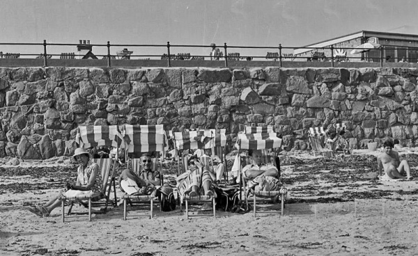 Deckchairs on the beach in 1970
 -
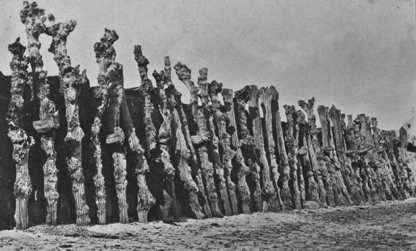 Victor Hugo at the Dicq (six tree trunks from the left) photographed by his son Charles in 1853


to view the location in Google Street View
