La Collette


La Collette is the southernmost point of the town of St Helier, stretching from the Harbour around to Havre des Pas. It was once an unspoilt coastal walk, with the road passing above it along Mount Bingham, but in post-war years a new power station was built, followed by a tanker berth and fuel farm on reclaimed land, and then the coastline was extended still further with a large land reclamation scheme, which now contains the island's refuse incinerator.
In the mid-19th century the States embarked on an ambitious project to build a large deep-water harbour with an arm stretching out from La Collette towards Elizabeth Castle, which would meet another arm from the castle. The latter was built and survives to this day, but as work progressed on the three-quarter mile long pier from La Collette it was breached in severe storms in the winters of 1874, 1875 and 1876 and the project was abandoned.
A contemporary report of a failed harbour development
The La Collette land reclamation scheme of the 1970s in pictures
La Collette, a pictorial timeline

to view the location in Google Street View

Click on image to see larger picture
-
 1809
1809 -
-
 19th century
 -
 A 19th century drawing showing the two diving stages
 -
 The tower in 1875
 -
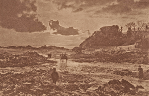
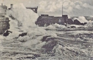
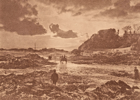
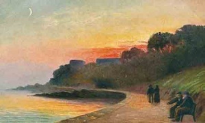
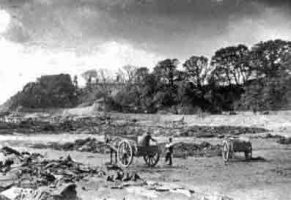
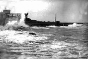 The storm of December 1876
 -
 The storm of December 1876
 -
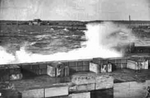
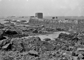
 Another storm in 1911
 -
 A picture by Edwin Dale
 -
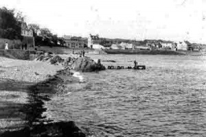
 1900
1900 -
 1905
1905 -


-
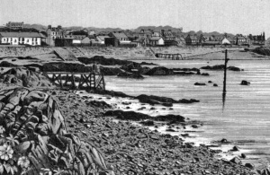
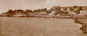
 La Collette in the 1930s
 -
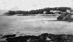
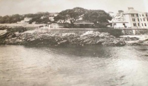
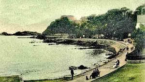
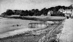
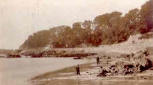
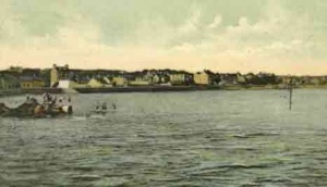
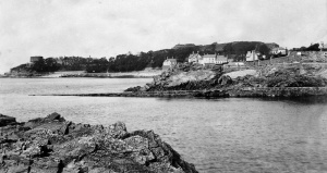
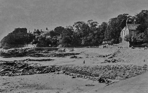
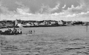
 A view from the sea
 -
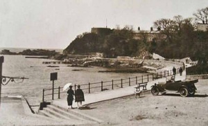
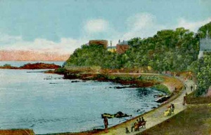
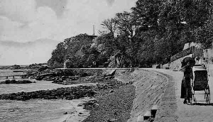
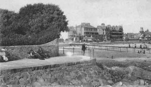
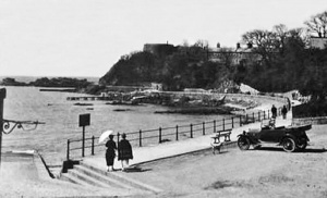
 A flat walk for a lady with a pram
 -
 An Albert Smith photograph
 -
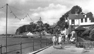
 1950s
1950s -
-
 1893 painting by Paul Martin in the Victoria and Albert Museum collection
 -
 The barracks seen from an unusual angle


.png)


-
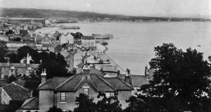
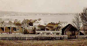 Looking out over Green Street, La Collette and Havre des Pas from the eastern side of Fort Regent
 -
-
-
-
-
-
-
-
-
-
-
-
-
 The ladies' diving stage at La Collette in 1910
 -
 The men's diving stage in 1889
 -


-
 1950, and the tracks have disappeared
 -
-
-
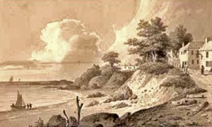
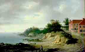 A 19th century painting of La Collette by John Young
 -
A photograph of La Collette by Albert Smith
-
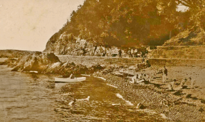
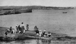
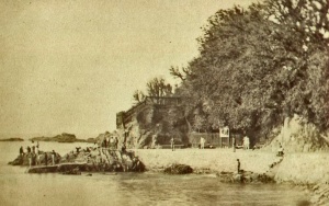
 Families on a day out at La Collette
 -
-
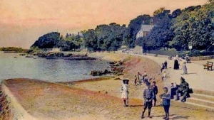
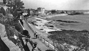
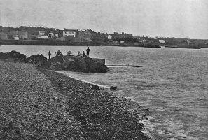
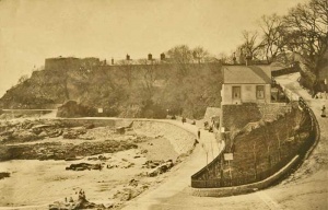
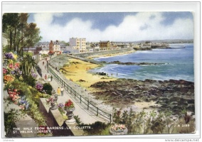 The walk
 -
 Vraic collecting in 1893 - a picture in the Victoria and Albert Museum collection
 -
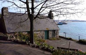 La Collette House
 -
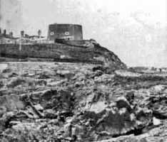
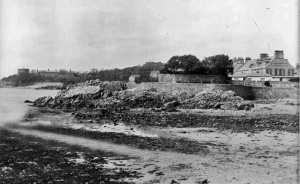
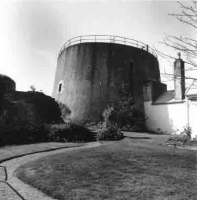 La Collette round tower
 -
 The slipway at the bottom of Green Street is the dividing line between the La Collette and Havre des Pas districts
 -
 Slipway at the bottom of Green Street
 -
-
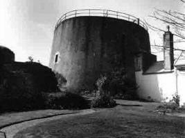 La Collette round tower
 -
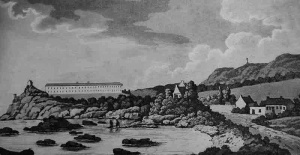
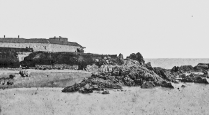
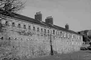
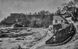
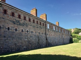
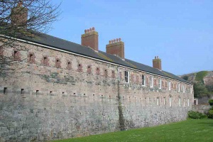 La Collette barracks


-
 1880
1880 -
 The men's bathing area in 1890
 -
 The men's bathing area photographed by Albert Smith
 -
 1940s
1940s -
-
 1978
1978 -
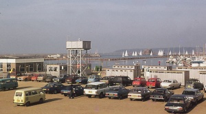 Cars parked on reclaimed land in the 1970s
 -
 The house on the hill leading to South Hill is The Nest
 -
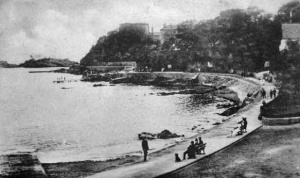
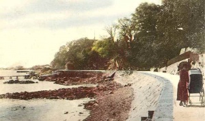
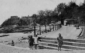
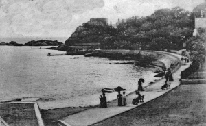
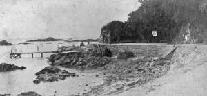
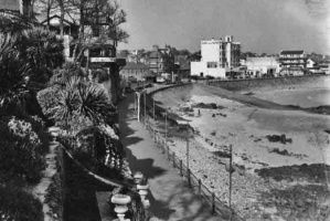
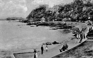
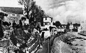
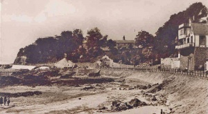
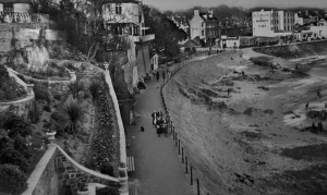 Looking down on the seaside walk in 1935
 -
 Early 20th century photograph
 -
 Newly planted trees at the bottom of the road up to South Hill
 -
 Gentlemen's bathing area at high tide
 -
 1971
1971 -
-
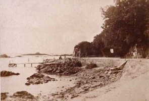
 1907
1907 -
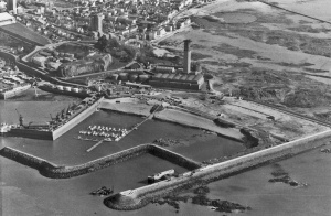
 Aerial photograph, 1968


20th and 21st century land reclamation

-
-
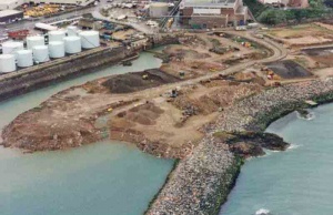
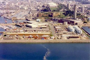
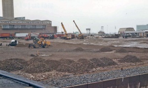
 La Collette reclamation phase 1
 -
 La Collette reclamation phase 1
 -
 La Collette reclamation phase 2
 -
 La Collette reclamation phase 2
 -
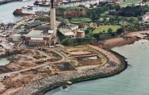 La Collette reclamation phase 2
 -
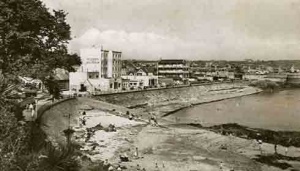
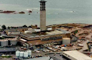
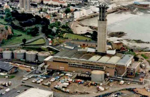
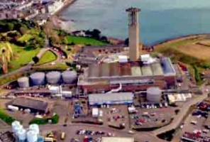 The island's power station at La Collette, little used today because most of Jersey's electricity needs are supplied via an undersea cable from France
 -
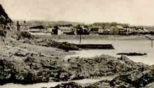
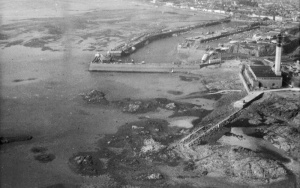
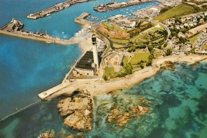
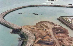
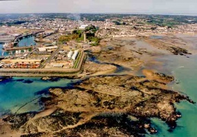 An aerial photograph taken before the reclaimed area was extended to take in the rocky area in the foreground
 -
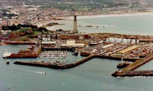
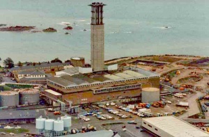 The Jersey Electricity power station in 1997
 -
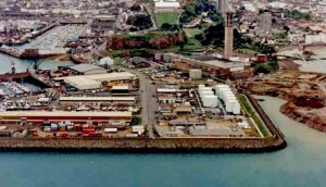
 The land reclamation boundary in 1996
 -
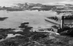
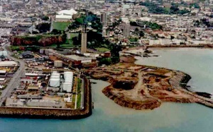
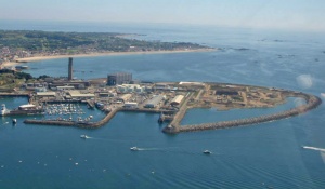
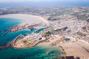 The area of reclaimed land has spread by 2011
 -
 La Collette reclamation


-
 La Collette reclamation
 -
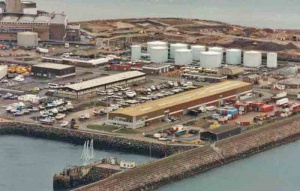 Fuel farm
 -
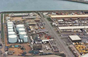 Fuel farm
 -
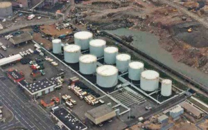 Fuel farm
 -
 Power station
 -
 Power station
 -
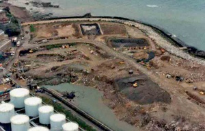 Reclamation site phase 2
 -
 2011
2011 -
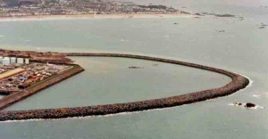
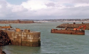 Work on the new tanker berth
 -
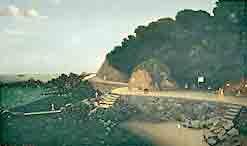
 Reclaimed land in the 1980s
 -
 Army barracks
 -