St Aubin's Bay
From Jerripedia
Jump to navigationJump to search

St Aubin's Bay

St Aubin's Bay is the main bay on the south coast of Jersey,
stretching between the towns of Saint Helier in the east and
Saint Aubin in the west
The building of St Aubin's Bay Seawall

to view the location in Google Street View


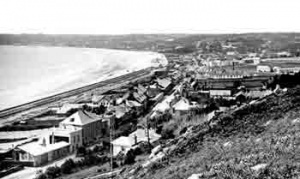
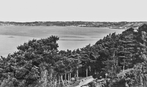
When this photograph first surfaced on Facebook it was described as Victoria Avenue under construction. That would date it to 1895-97. However, it must have been taken much earlier because there is no railway track visible. The picture must have been taken in 1869, the year the States gave their approval to the construction of a railway between St Helier and St Aubin, which necessitated the building of a seawall to protect the track from the sea. The picture shows work progressing to the south of the Lower Park. The fact that the railway opened in 1870 shows how fast the project was undertaken. Sufficient land was reclaimed to allow for the construction of the railway line and leave space for the eventual construction of a wide road between West Park and Bel Royal. Initially the track ran some distance inland from the wall, in something of a hollow, but it was moved next to the wall when the reclaimed area was filled in to allow for the construction of the road. This was completed in 1897 and, after initially being called Boulevard Baudains, the new road was renamed Victoria Avenue. It became Jersey's only stretch of dual carriageway in the 1950s, having initially been used exclusively by horse-drawn carts and carriages. It became busier and busier after the introduction of the motor car to the island and today carries the bulk of commuter traffic from the west of the island to the capital town of St Helier. The picture below shows the view from almost exactly the same location, after the completion of the new road

Today a road runs the full length of the bay linking St Helier and St Aubin. The busiest stretch from West Park to Bel Royal is called Victoria Avenue. Construction of this road, now a dual carriageway, was not undertaken until the final years of the 19th century, before which traffic passed further inland on St Aubin's Road. The Jersey Railway line ran along the shoreline from 1870, and before that low sand dunes were washed by the high tide and the quickest way to drive a horse and cart from one end of the bay to the other was along the beach at low tide. When St Aubin was the island's principal port and St Helier was beginning to develop as a population centre, but without its own port, this is exactly how imported goods were moved from one town to the other


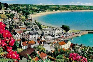
2025 view from the heights of St Aubin
Click on any image below to see a larger version
-
 1952
1952 -
 1950
1950 -
-
 1920s
1920s -
-
-
-
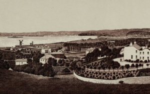
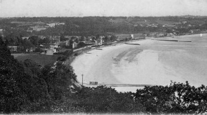
 The bay in 1893
 -
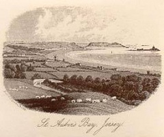
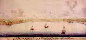 The bay in the 17th century
 -
 The bay in 1970
 -
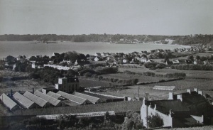
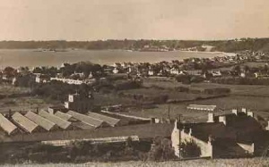
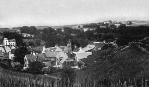
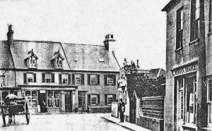 Later in the 19th century a small village is developing at Beaumont
 -
-
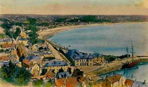
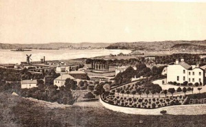
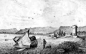
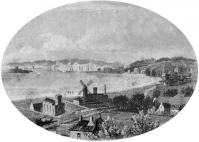 St Aubin's Bay by Ouless. St Matthew's Church, the coastal tower, now demolished, and windmill, stand isolated in the centre of the bay
 -
-
 La Haule to Beaumont
 -


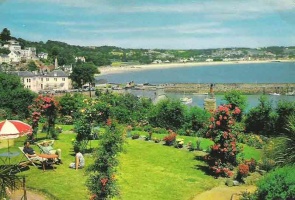
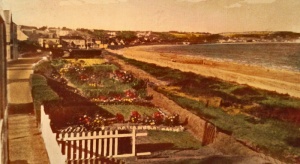
Seaside gardens at Bel Royal
-
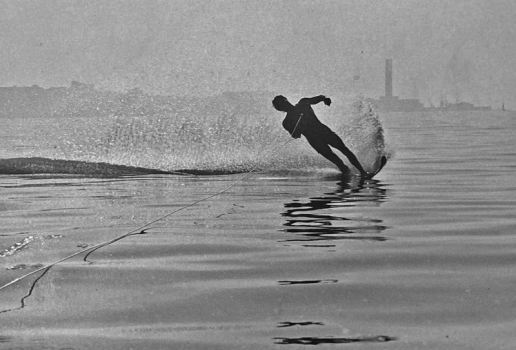 Water skiing in the bay - La Collette power station chimney in the background
 -
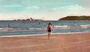
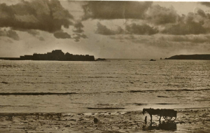
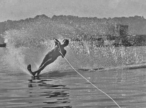 Water skiing in the bay - St Aubin's Fort in the background


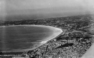
Aerial view on approach to Jersey Airport
-
-
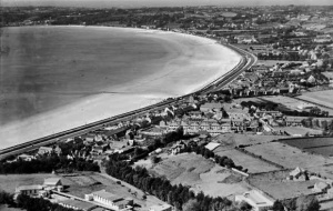
 1933 aerial photograph by Aerofilms
 -
 1933 aerial photograph by Aerofilms
 -
 1956
1956 -
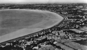 An aerial view sent as a postcard in 1937, but probably taken in 1933
 -
-
-
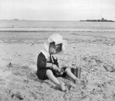 On the beach at St Aubin in 1909
 -
 From a 1949 calendar
 -
![La Haule before a road was built]]](/w/images/thumb/e/e7/La_Haule.jpg/300px-La_Haule.jpg) La Haule before a road was built]]
La Haule before a road was built]] -
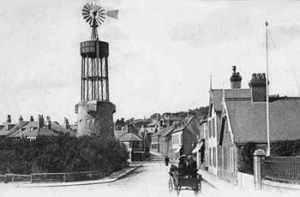 For many years a windmill stood on the Martello tower at First Tower
 -
 Beaumont in 1863 before the coast road was built
 -
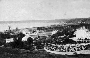
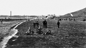 People's Park at the eastern end of the bay in 1893 just before Victoria Avenue was built
 -
-
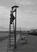 New lamps were installed on the seaside promenade in 1955
 -
 An unusual view from Westmount


.jpg)


![La Haule before a road was built]]](/wiki/File:La_Haule.jpg)


.png)


2024 drone photograph by Paul Lakeman looking west from Bel Royal. Visit his Facebook group for a large selection of photographs looking down on Jersey's coasts.
