German installations: St Ouen's Bay

German installations:
St Ouen's Bay

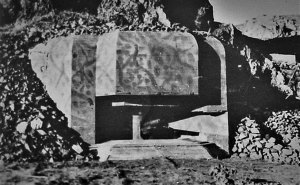
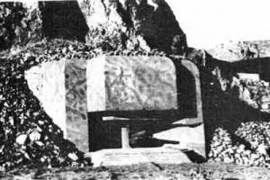
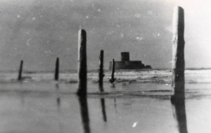
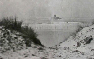
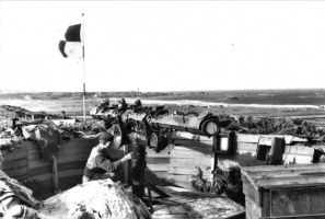
A clandestine photograph of anti-landing craft posts at La Rocco

to view Kempt Tower in Google Street View
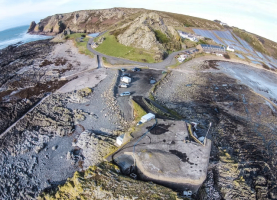
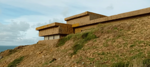
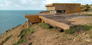
This page contains pictures of defences installed by the Germans in St Ouen's Bay during the Occupation as part of Hitler's Atlantic Wall, which was designed to prevent any Allied invasion of occupied territory. More pictures of defences at other locations, and links to pages for other major installations, will be found in Photographs of German defences and other installations. More pictures of St Ouen's Bay will be found in The 'green books'

Carriere


Steps 43
This resistance nest was part of Unterabschnitt Ouens Bay Mitte (Defensive Sub-Sector Middle of St Ouen's Bay), manned by troops of the 1st Company of Machine Gun Battalion 16. As there were no pre-war landmarks on the 1933 Ordinance Survey maps, the resistance nest takes its name from the only thing shown at this point which is 'Steps' (on to the beach) and a nearby height point (43 feet). It was manned by four NCOs and 16 other ranks


Les Brayes
This resistance nest was on the St Ouen's Bay coast north of Carriere


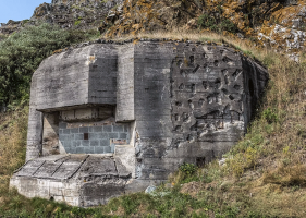
La Crabiere
The area north of Kempt Tower at La Crabiere was heavily fortified


Dune


Ville au Bas


Doktorhaus


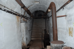
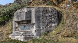
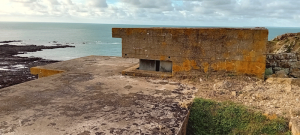
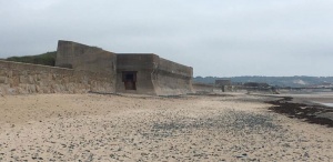
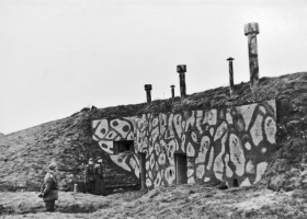
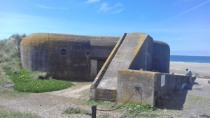
El Tico
The bunker at El Tico has been extensively restored and is regularly opened to the public. These pictures by David Priddis were taken from a Facebook post


La Mare Mill
This resistance nest formed part of the second line of defence to engage and prevent an invasion force from making progress to the St Ouen hillsides


Hohe 266
This resistance nest provided a second line of defence below the Airport


La Thiebaud
This resistance in St Ouen's Bay was north of La Crabiere and Lewis Tower


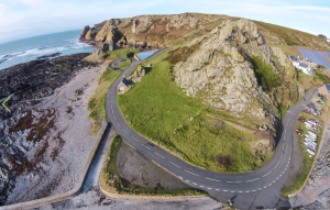
L'Etacq
L'Etacq, at the northern end of St Ouen's Bay was heavily defended
-
-
-
-
-
-
-
-
-
-
-
-
-
-
-
-
-
-
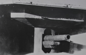
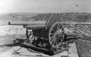
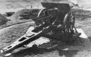
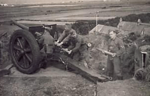
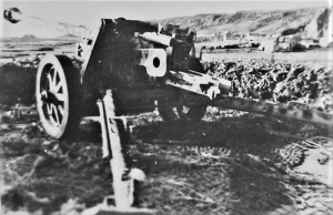 Field gun at L'Etacq
 -
 Field gun at L'Etacq
 -
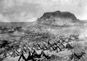
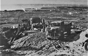
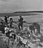
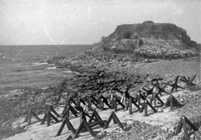 Anti-tank obstacles photographed at L'Etacq in 1944
 -
 L'Etacq
 -
 L'Etacq
 -
 L'Etacq
 -
 L'Etacq


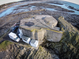
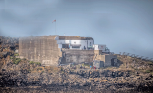
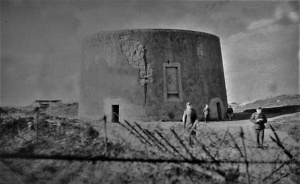
High Tower


L'Oeilliere
This resistance nest was at La Pulente at the southern end of St Ouen's Bay
File:W26Oeilliere1.png|
File:W26Oeilliere2.png|
File:W26Oeilliere3.png|
File:W26Oeilliere4.png|
File:W26Oeilliere5.png|
File:W26Oeilliere6.png|
File:W26Oeilliere7.png|
File:W26Oeilliere8.png|
File:W26Oeilliere9.png|
File:W26Oeilliere10.png|
File:W26Oeilliere11.png|
File:W26Oeilliere12.png|
File:W26Oeilliere13.png|
File:W26Oeilliere14.png|
File:W26Oeilliere15.png|
File:W26Oeilliere16.png|
File:W26Oeilliere17.png|
File:W26Oeilliere18.png|
File:W26Oeilliere19.png|
File:W26Oeilliere20.png|
File:W26Oeilliere21.png|
File:J23OccupationL'OeillierePoint.jpg|L’Oeilliere Point
</gallery>
Lewis Tower


Miscellaneous locations
-
-
-
-
-
-
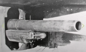
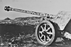
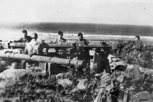
 German gun in St Ouen's Bay
 -
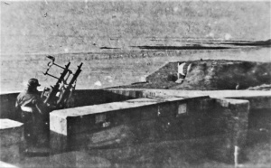
 Rangefinder in St Ouen's Bay
 -
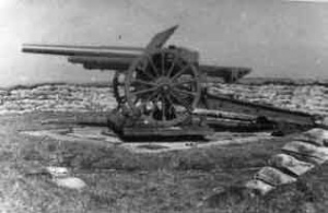
 Blanches Banques artillery
 -
 Blanches Banques artillery
 -
 Blanches Banques artillery
 -
 Blanches Banques artillery
 -
-
 Mont Rossignol
 -
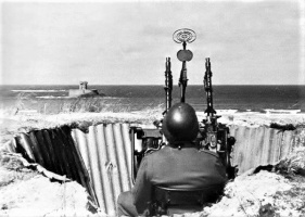
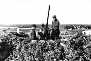
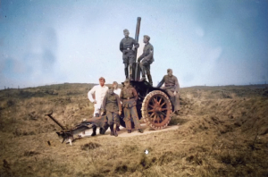
 An anti-aircraft gun at Mont Rossignol
 -
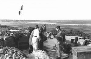
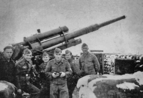 Luftwaffe crew at Mont Rossignol
 -
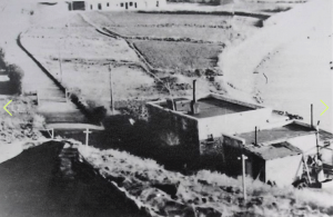
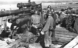
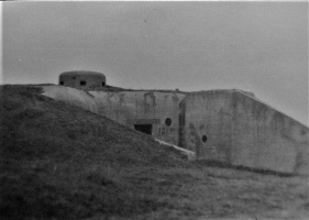
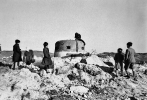
 St Ouen's Bay casemate in 1944
 -
 St Ouen's Bay casemate in 1944
 -
 St Ouen's Bay casemate in 1944
 -
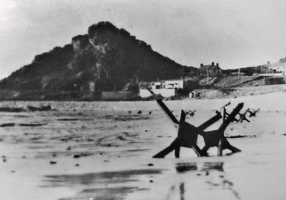
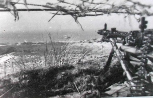
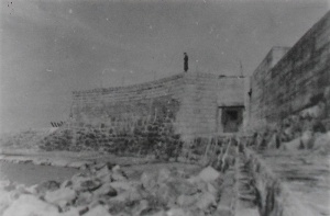
 Anti-landing craft posts in St Ouen's Bay
 -
 Anti-landing craft posts in St Ouen's Bay
 -
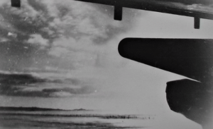
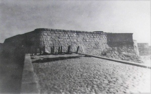
 The seawall in St Ouen's Bay
 -
 A rangefinder in St Ouen's Bay
 -
 Anti-aircraft gun in St Ouen's Bay
 -
 St Ouen's Bay rangefinder
 -
 Mont a la Brune
 -
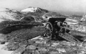
 Mont Matthieu in 1944
 -
 Anti-aircraft gun in St Ouen's Bay
 -
-
 Mont a la Brune
 -
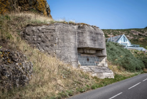
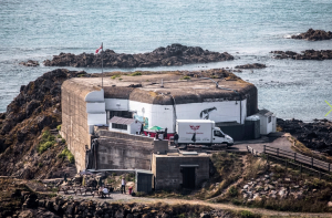
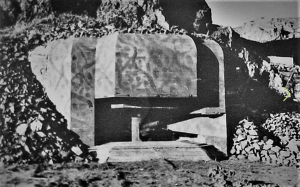
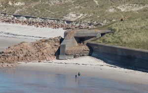
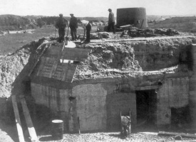
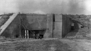
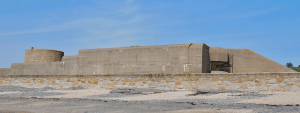
 One of the substantial bunkers at Le Braye
 -
-
-
-


.jpg)


