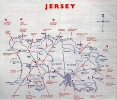
Maps

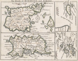
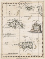
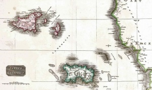
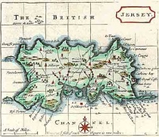
Maps of Jersey and the Channel Islands

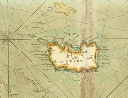
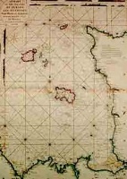
A 16th century map showing St Aubin's Bay, one of the earliest known maps of the island. The map is orientated east at the top, and the two structures in the bay are Elizabeth Castle (top) and St Aubin's Fort
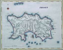
This page contains the largest online collection of maps of Jersey and the other Channel Islands. The maps cover the period from the 16th century to the 20th, and there are links to pages containing detailed images of some of the most important maps. Jersey Heritage has a larger collection of maps but they are not accessible online


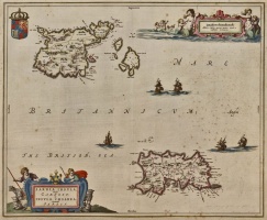
- A 1672 Atlas
- 1849 Godfray map index
- Ordnance Survey maps, 1912 and 1935
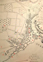
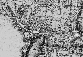
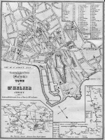
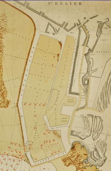
- 1834 Le Gros map of St Helier in detail
- 1680 map of Jersey one of the earliest showing details
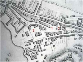
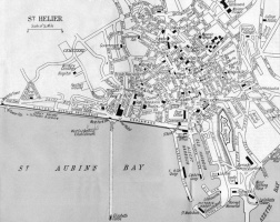
- Maps of St Helier: A selection of town maps showing how the island's capital developed
- Growth of St Helier 1737-1834: And three maps showing in detail the growth over a century

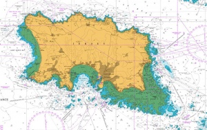
Coastal survey
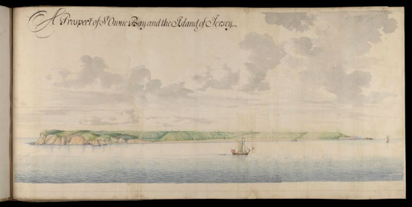
Not maps, but drawings of Jersey's coastline from a 1680 survey by Gomme
-
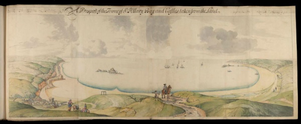 Looking out over St Aubin's Bay from inland
 -
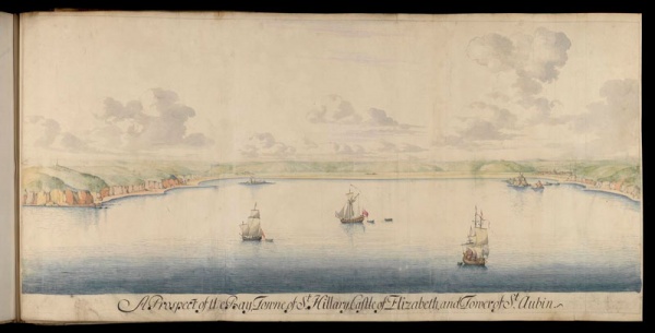 St Aubin's Bay from out at sea
 -
-
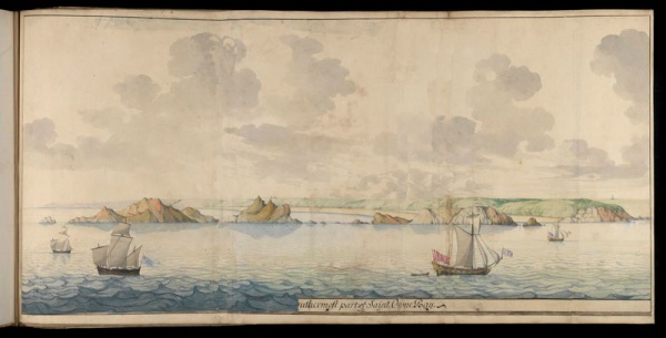 La Corbiere from much closer in, long before the lighthouse was built


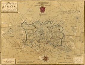
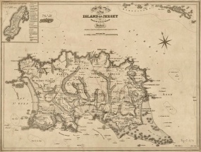
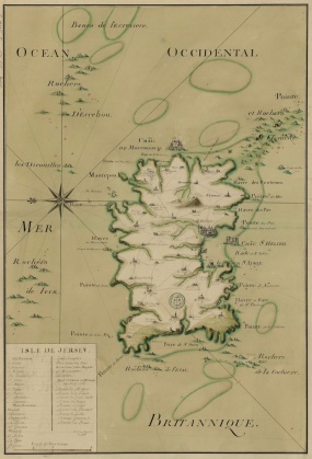
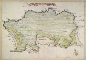
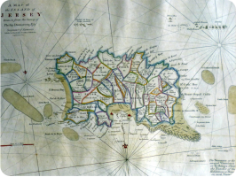
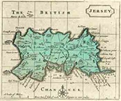
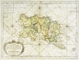
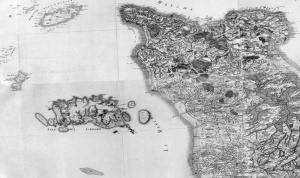
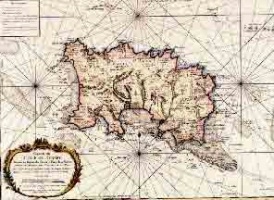
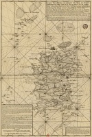
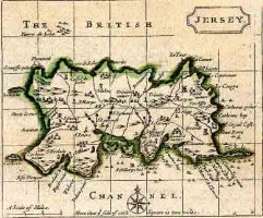
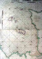
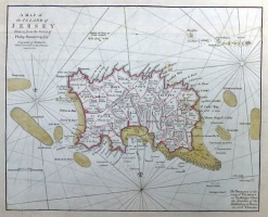
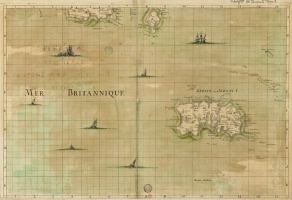
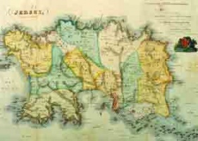
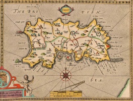
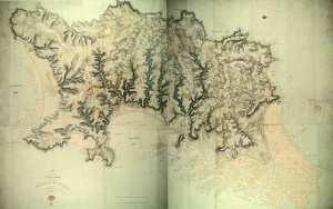
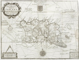
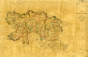
1783 map of Jersey


|

|

|

|

|

|

|

|
|
Bibliotheque Nationale
These maps from the Bibliotheque Nationale collection in Paris are also included in appropriate sections below. Click on any map to open a zoomable version on the Bibliotheque site, in a new tab, or new window, depending on your browser settings
 Unknown date - Zoom in on this map
|
 18th century - Zoom in on this map
|
 1894 - Zoom in on this map
|
 1595 - Zoom in on this map
|
 1755 - Zoom in on this map
|
 1757 - Zoom in on this map
|
 1778 - Zoom in on this map
|
 1779 - Zoom in on this map
|
 1836 - Zoom in on this map
|
 Herman Moll, c1730s - Zoom in on this map
|
 Piquet, 19th century - Zoom in on this map
|
 1873 - Zoom in on this map
|
 Tibbles town map - Zoom in on this map
|
 1746 - Zoom in on this map
|
 1645 - Zoom in on this map
|
 Bartholomew map of St Helier - Zoom in on this map
|
 1756 - Zoom in on this map
|
 1864 - Zoom in on this map
|
 1754 - Zoom in on this map
|
 1757 - Zoom in on this map
|
Dated maps

-
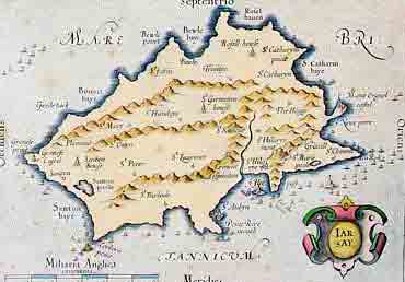
 The 1637 Mercator map of Jersey is in the Bodleian Library. At first glance it appears to resemble Guernsey more than the larger island but if it it rotated slightly clockwise the outline of Jersey's coast becomes more apparent
 -
 A modern coloured version of the 1637 Mercator map
 -
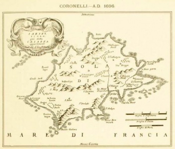 And a better quality copy published in Italy in 1696 by Franciscan monk Vincenzo Coronelli from Venice. Quite why he turned his attention away from his trademark globes and atlases to copy a map of Jersey published 59 years earlier is unknown


-
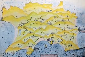
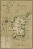
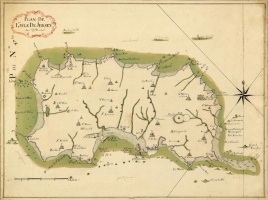
 A 1543 map of St Aubin's Bay known as 'The Haven of Jersey' showing east at the top
 -
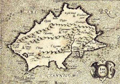
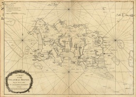
 Richard Popinjay Map, 1562 or 1563
 -
 Detail of Mont Orgueil Castle from the Popinjay map
 -
 1645
1645 -
 A map produced for Charles II in 1681 ...
 -
 ... clearly based on the same map, with with notable differences
 -
 A woodcut map published in Paris in 1683. Designed by the French mathematician, engineer and surveyor Allain Manesson-Mallet (1630-1706), it was originally produced for his Description de l’Univers : Contenant les Differents Systemes du Monde.
 -
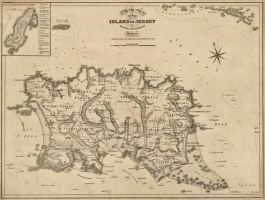
 A map drawn from Dumaresq's survey of 1685
 -
 St Helier in 1691
 -
 St Helier in 1691
 -
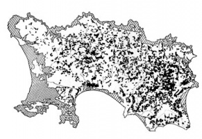 A map showing the proliferation of apple orchards in the 17th century
 -
 A map drawn by John Seller in the late 17th century and published by S Hooper of London in 1787. It first appeared under the title Anglia Contracta in about 1694 and was then included as a revised version with Francis Grose's The Antiquities of England and Wales. The original measured only 120 x 143 mm
 -
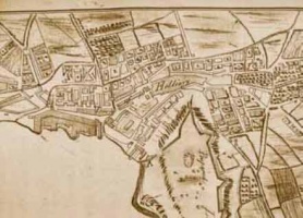
 A map of the small town of St Helier in the late 17th century ...
 -
 ... and a map of the wider area of St Helier in 1755


-
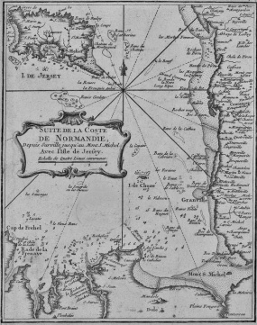
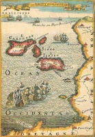
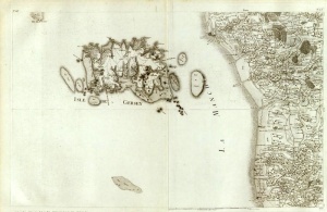
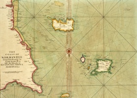 Normandy and the Channel Islands in 1705
 -
 Jersey 'upside down' from the French map
 -
 1717
1717 -
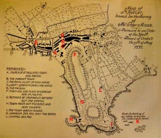 Meade's map of the town of St Helier in 1737 - see Maps of 18th century St Helier for key
 -
 Herman Moll, c1730s
 -
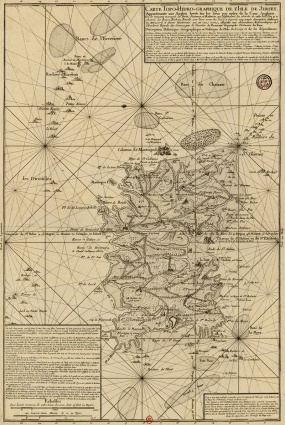
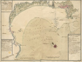 1737 survey of St Aubin's Bay
 -
 1746
1746 -
 Admiralty chart, 1746
 -
 Thomas Osborne 1748
 -
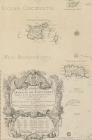
 Jersey appears on the Carte de France, which was published by four generations of the Cassini family from 1750 to 1815. The original carte consists of 182 sheets at the same scale, allowing the sheets to be joined together to form a physical map of nearly 12 metres square. This historical cartographic image is part of the David Rumsey Historical Map Collection
 -
 Jersey and the Cotentin coast of Normandy, 1750
 -
 John Rocque, 1753
 -
 Herman van Loon , 1753
 -
 Thomas Kitchin in the London Magazine, 1753
 -
 1754
1754 -
 A 1755 map by Jacques Nicolas Bellin
 -
 1755
1755 -
 1756
1756 -
 St Helier, 1756
 -
 1757
1757 -
 1757
1757 -
 Cassini, 1758
 -
 Joseph Ellis, 1766
 -
 A 1772 map by Francis Grose
 -
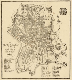
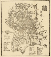 Tibbles town map
 -
 1778
1778 -
 1779
1779 -
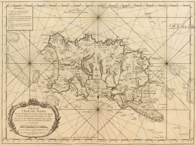
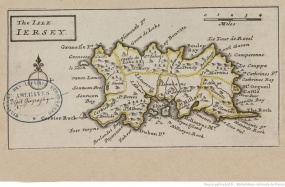
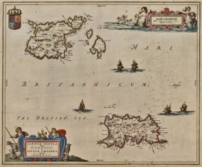
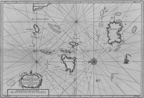
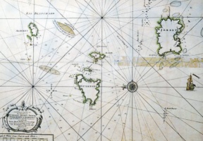
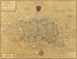
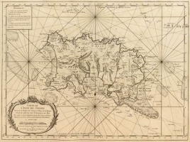
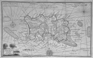
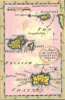
 A map of the Channel Islands by Louis de la Rochette from 1781
 -
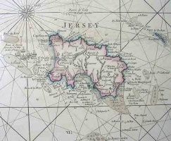 A map by Louis Stanislaus de la Rochette, published in Paris in 1781, the year of the Battle of Jersey
 -
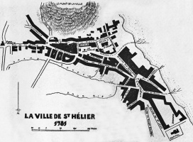 St Helier 1781
 -
 Another map of St Helier in 1781
 -
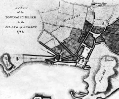 1781
1781 -
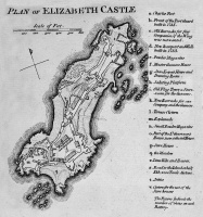 Elizabeth Castle, 1783
 -
 Thomas Condor's 1784 map
 -
 Momonier's 1787 map shows that the town is starting to grow, albeit very slowly - see Maps of 18th century St Helier for key
 -
 John Cary, 1789, after Dumaresq
 -
 Prince Bouillon map, 1799
 -
 St Helier 1790
 -
 Duke of Richmond map, 1795
 -
 St Helier in 1797


1789.jpg)


-
 18th century
 -
 Pinkerton, 1813
 -
 A map by John Pinkerton from 1814
 -
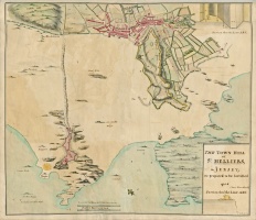
 A map in Richard Plees' 1817 guide to Jersey
 -
 Map drawn by surveyor Roger Creighton and engraved by admiralty engravers John and Charles Walker. Produced for the Topographical Dictionary published by Samuel Lewis of Aldersgate in 1831
 -
 1836
1836 -
 From Mudie's History of Hampshire in 1838
 -
 A map from 1846
 -
 A map by John Creighton from 1848
 -
 1849
1849 -
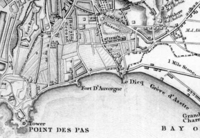
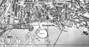
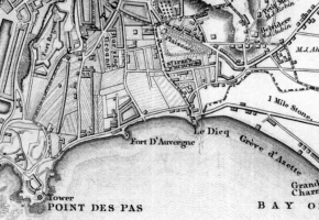 Havre des Pas, 1849
 -
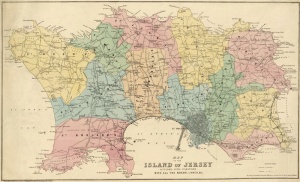
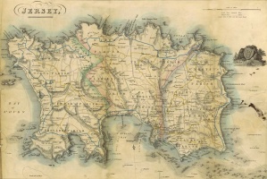
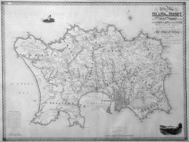 Godfray map 1849
 -
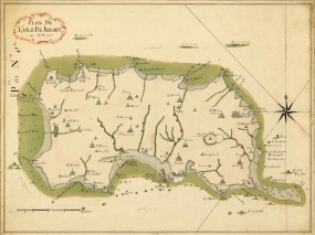
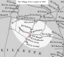 Godfray, Les Landes, 1849
 -
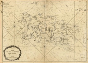
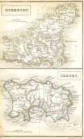
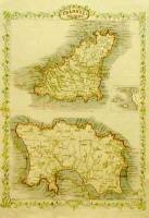
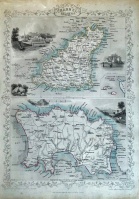 A map published by John Tallis of London and New York in about 1850. It shows Guernsey above Jersey. It was drawn and engraved by John Rapkin (1813-1899) with additional decorative work by Henry Winkles and Edward Radclyffe.
 -
 1860 map
 -
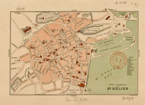
 St Helier, 1861
 -
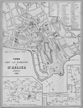
 1864
1864 -
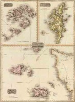
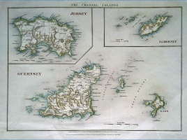
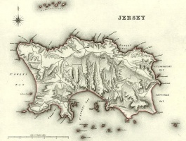
 An 1865 map of Guernsey (above) and Jersey
 -
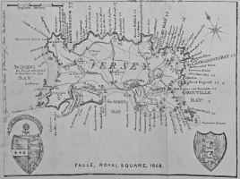 Map published by Falles, of the Royal Square, in 1868
 -
 Bartholomew, 1870
 -
 1873
1873 -
 1894
1894 -
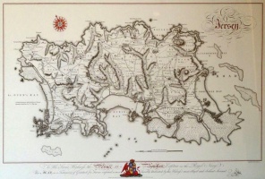
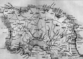
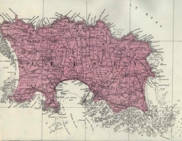
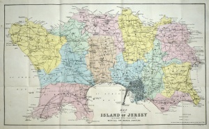
 Godfray's 19th century map of Jersey
 -
 Piquet, 19th century
 -
 Jersey on an updated 1902 Cassini map
 -
 From the 1902 Cassini map
 -
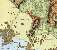
 St Helier, 1910
 -
 St Helier, 1930
 -
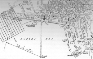 A map showing the area used for beach landings in the 1930s
 -
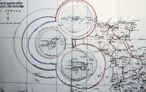 German artillery range map
 -
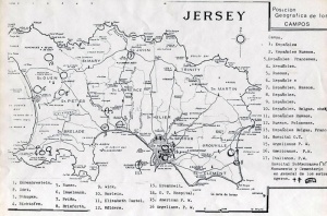 Location of prison camps during the German Occupation
 -
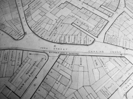 York Street, c1950
 -
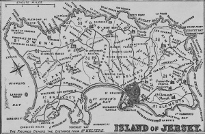
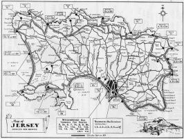 A map of bus routes in 1957
 -
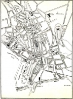
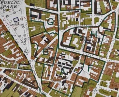 Town of St Helier, 1960s
 -
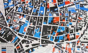 1961 Building age survey
 -
 Havre des Pas, 1977
 -
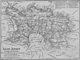
 Tourist map, 1980
 -
 South-east of the island, 1988
 -
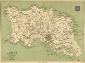
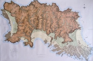
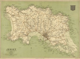
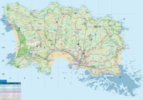
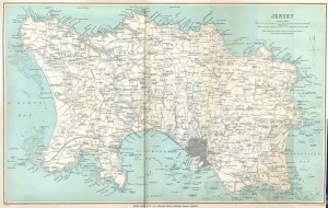
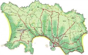 A modern map of Jersey showing the major road network


Some very old maps
-
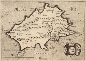
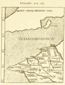 Ptolemy 140AD
 -
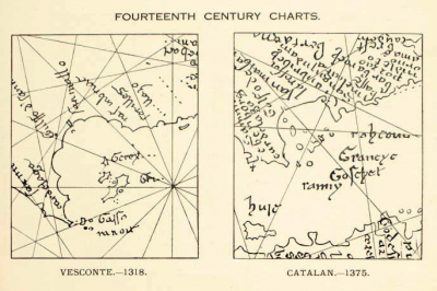 14th century charts
 -
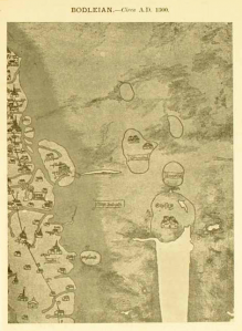 Bodleian 1300
 -
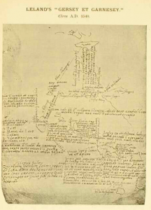 Leland 1540
 -
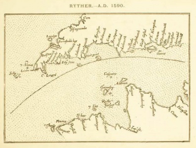 Ryther 1590
 -
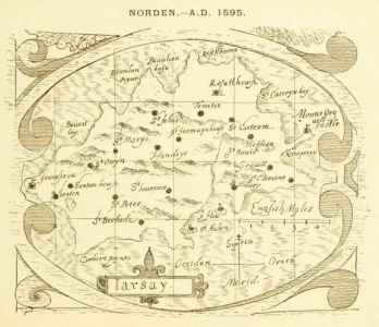 Norden 1595
 -
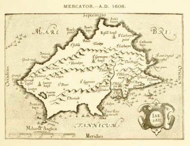 Mercator 1606
 -
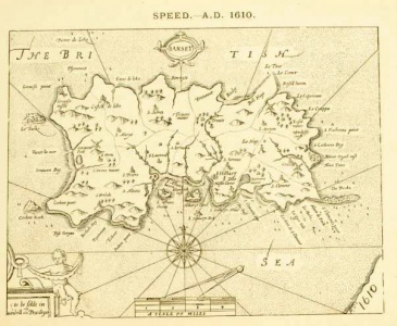 Speed 1610


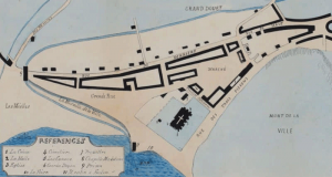
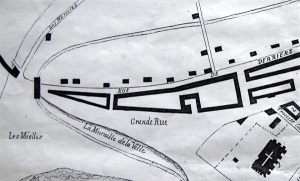
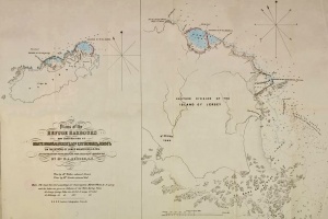
St Helier Harbour in 1878
-
 The whole map
 -
 Close-up of the harbour area


Miscellaneous maps

-
-
-
-
-
 A map by William Hooper
 -
 Early town map
 -
-
-
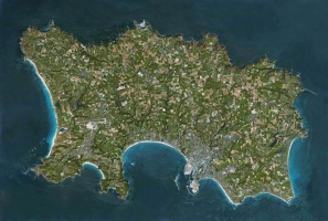
 Satellite photograph
 -
 Aerial photograph
 -
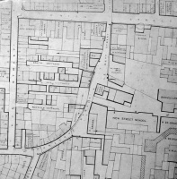 Hue Street area before a large number of cottages were demolished
 -
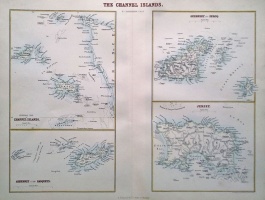
 Coutances Diocese map of the Channel Islands
 -
 A map showing the distance of various points in the island from the Royal Square
 -
 Plans for new harbours in Alderney and Jersey
 -
-
 Cycling routes
 -
-
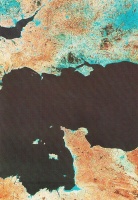
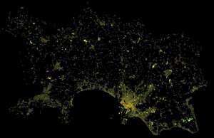 A thermal image map
 -
-
-
-
-
 A Russian map of Jersey
 -
 A map produced for visitors in 1899
 -
-
-
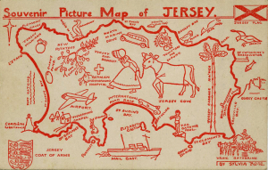 1950s souvenir picture map


Tourism promotion maps


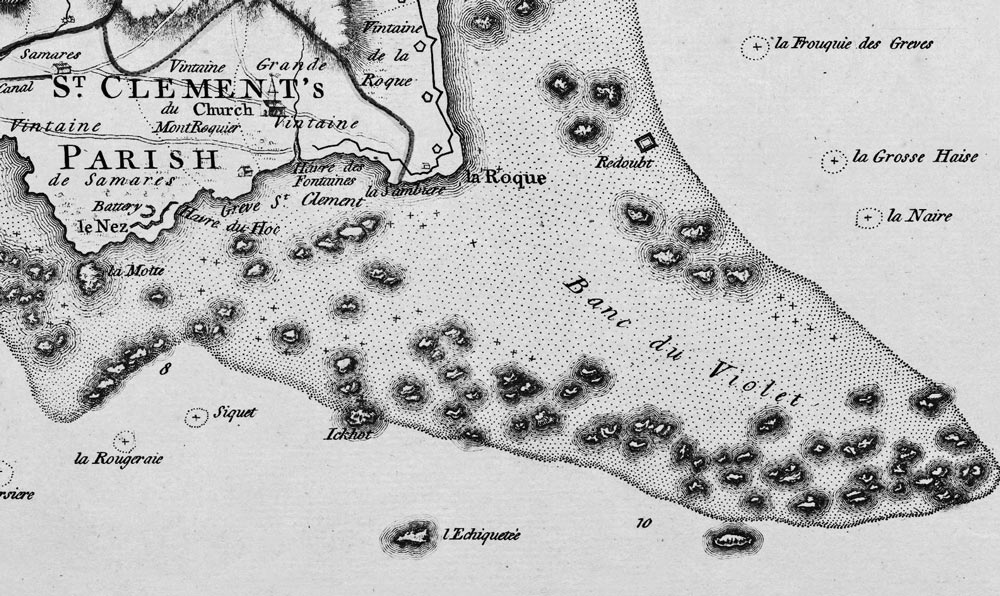
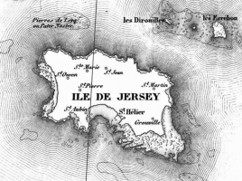
Dirouilles

Societe donation
In November 2025 La Société Jersiaise announced that it had received a donation of 400 maps from Gerald Trevor, and that they were in the process of digitising and cataloguing them.
- "Following several months of detailed description work, our dedicated volunteers, Sue and Kim, have now begun the digitisation of Mr Trevor’s maps, ensuring that this valuable collection can be preserved and made more widely accessible. Meanwhile, Jeremy, our Library Assistant, and Valérie, the Librarian, have started cataloguing the collection within the Library’s online database. Although this is a meticulous and time-consuming project, once completed it will provide an invaluable resource for researchers, historians and map enthusiasts alike."


